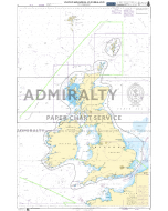
C-MAP MAX - North and Baltic Seas
Share:

SKU
MAX04
£280.00
- FREE Delivery to UK - Spend over £75
- FREE Delivery to Europe - Spend over £150
- Worldwide Delivery Available
Overview
C-MAP MAX - North and Baltic Seas
Product Details
Part Number: MAX04
Manufacturer: No
Scale: No
Publisher: C-MAP
Format: SD-Card or C-Card
Technology: MAX
How to Order your C-MAP Charts in 4 Easy Steps
- Browse and choose your chart coverage area from the image (click on it to enlarge)
- Select your Data Card Type
- Select your chosen Chart Area from the drop down list
- Add your C-MAP compatible chart plotter make and model number into the text box (If you are unsure, please refer to the compatability list or contact us)
You are now ready to add your selection to your cart
- W85 - Baltic Sea and Denmark [EN-M299]
- W86 - North Sea and Denmark [EN-M300]
- MW4 - North and Baltic Seas [EN-M019]