Imray chart coverage is divided into several series:
- Northwest Europe - C charts provide general scale coverage with plan insets at larger scales: Y charts and the 2000 series small format chart folios offer larger scale coverage
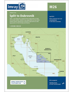
- Mediterranean - G and M series provide general scale coverage with plan insets
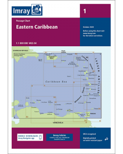
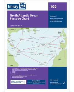
- Atlantic and Eastern Caribbean - Imray-Iolaire charts A, B, D, and E series provide general scale coverage with plan insets.
Sheet sizes
C charts: 787 x 1118mm (31” x 44”)
All others: 640 x 900mm (25” x 351/2”)
2000 series: A2 590 x 420mm
Why use Imray Charts?
Imray charts set the standard for the leisure sector with award-winning cartography which features our distinctive colour scheme, coloured light sectors and fine overprinted latitude and longitude grids to make plotting easier.
Our charts are quality controlled at all stages of production. Based on up-to-date official hydrographic surveys, they receive continual attention and amendment by our staff, who monitor corrections to ensure that our charts are always as correct as possible when dispatched.
All Imray charts are now based on WGS 84 datum. Apart from some of the Imray-Iolaire charts of the Caribbean Sea, all are metric.
Every chart includes details of the datum and projection on which it was based, to allow it to be used safely with GPS navigation systems.
Imray charts have been awarded official MCA (Maritime and Coastguard Agency) recognition for use on Code vessels and fishing vessels under 24m in length.
Corrections
Charts are correct to the date of printing and are supported by corrections which may be downloaded from this web site until a new edition is compiled. Once a new edition has been published the old edition cannot be corrected, is regarded as being unsafe for navigation and should be replaced.
Correction notices for individual Imray charts may also be downloaded from these pages.
Digitally printed on waterproof paper
Imray charts are now printed digitally on published on Pretex, a partially synthetic paper, which folds well and is durable in damp conditions. It may be drawn on in both soft pencil and ballpoint pen.
Imray charts are normally published to an approximately A4 fold format in a wrap around cover and supplied in robust PVC wallets. Flat sheets are available on request.
![1820 IJsselmeer, Markermeer, Noordzeekanaal en Ijsseldelta [PRE-ORDER]](https://www.bookharbour.com/media/catalog/product/cache/f073062f50e48eb0f0998593e568d857/n/l/nl1820.jpeg)
![ADMIRALTY Chart 5047: Bristol Channel [Instructional Chart]](https://www.bookharbour.com/media/catalog/product/cache/f073062f50e48eb0f0998593e568d857/5/0/5047.jpg)
