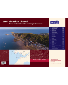
2600 The Bristol Channel Chart Pack

- FREE Delivery to UK - Spend over £75
- FREE Delivery to Europe - Spend over £150
- Worldwide Delivery Available
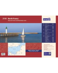
Trevose Head to St David's Head including the River Severn
Product Details
Part Number: YOT0858
Scale: 1:1(Various)
ISBN: 9781786794314
Publisher: Imray Laurie Norie And Wilson Ltd
Manufacturer: Imray Laurie Norie And Wilson Ltd
Edition: 2023
Printed and corrected to: April 2023
Format: Folio - A2 Size
Language: English
MPN: IC2600-3
The chart specification has been improved to show coloured light flashes. There has been general updating throughout.
Individual charts from this atlas are no longer available to purchase separately - Chart Y26 contains coverage of Milford Haven and River Cleddau to Haverfordwest (also covered by sheets 2600.11 and 2600.12)
The atlas contains 12 sheets-
2600.1 Trevose Head to St David’s Head 1:450, 000 WGS 84
2600.2 Padstow to Hartland Point 1:120, 000 WGS 84
Plans Approaches to Padstow, Bude Haven
2600.3 Hartland to Ilfracombe 1:140, 000 WGS 84
Plans Barnstaple to Bideford, Lundy, Continuation to Barnstaple
2600.4 Approaches to the Bristol Channel 1:130, 000 WGS 84
2600.5 Ilfracombe to Nash Point 1:130, 000 WGS 84
Plans The Mumbles, Swansea Marina, Porthcawl, Ilfracombe
2600.6 Nash Point to Flat Holm 1:80, 000 WGS 84
Plans Watchet
2600.7 Flat Holm to Avonmouth 1:70, 000 WGS 84
Plans Cardiff Bay
2600.8 River Severn to Sharpness 1:50, 000 WGS 84
Plans Sharpness
2600.9 River Avon 1: 20, 000 WGS 84
Plans River Avon (continuation)
2600.10 Tenby to Skomer Island 1:135 000 WGS 84
Plans Jack Sound, Tenby & Caldey Island
2600.11 Milford Haven - St Ann’s Head to Neyland Point 1:30, 000 WGS 84
Plans Milford Marina
2600.12 River Cleddau - above Neyland Point 1:25, 000 WGS 84
Plans Neyland Yacht Haven, Continuation to Haverfordwest
Imray Digital Charts: Free mobile download
A voucher code to download the relevant Imray digital charts into our Imray Navigator app is included with this atlas.


![NP255 - ADMIRALTY Tidal Stream Atlas: Falmouth to Padstow [including Isles of Scilly]](https://www.bookharbour.com/media/catalog/product/cache/f073062f50e48eb0f0998593e568d857/n/p/np255_1.jpg)