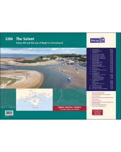
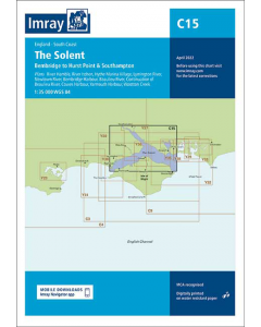
2200 The Solent Chart Pack

- FREE Delivery to UK - Spend over £75
- FREE Delivery to Europe - Spend over £150
- Worldwide Delivery Available
Printed and corrected to February 2024
Product Details
Part Number: YOT0853
Scale: 1:1(Various)
ISBN: 9781786795656
Publisher: Imray Laurie Norie And Wilson Ltd
Manufacturer: Imray Laurie Norie And Wilson Ltd
Edition: 2024
Printed and corrected to: February 2024
Format: Folio - A2 Size
Language: English
MPN: IC2200-9
A convenient A2 format chart pack of The Solent and Isle of Wight provided in a sturdy plastic wallet.
This fully revised and extended edition of our popular Solent chart pack has been redesigned and expanded to 16 sheets. It includes the latest official UKHO data combined with additional information sourced from Imray's network to make it ideal for small craft.
The chart pack includes all the navigational charts and tidal data for passage, approach and mooring. Included in this edition is improved coverage of the East Solent harbours.
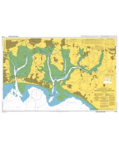
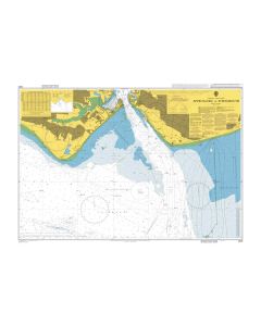
Chichester, Langstone and Portsmouth Harbour are now shown across five new sheets allowing these harbours and approaches to be covered at a better scale. A new sheet has been added to show coastal navigation off the south coast of Isle of Wight, and a new index sheet of the Solent Approaches is now included.
New: Vessel Traffic Services (VTS) reporting points
Imray charts for the Solent and approaches now include all VTS reporting points found in these waters. VTS reporting is mandatory for vessels of more than 20m in length that are bound to and from the Solent.
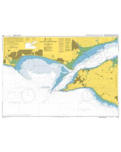
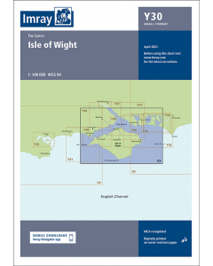
2200.1 Solent Approaches (1:300 000)
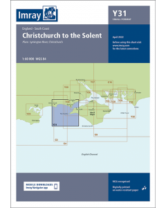
2200.2 Christchurch to the Solent (1:60 000)
Plans: Lymington River (1:15 000)
Christchurch (1:20 000) 2200.3
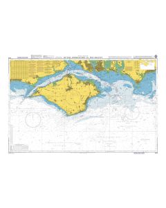
South Coast of the Isle of Wight (1:60 000)
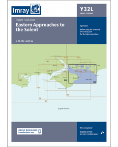
2200.4 Eastern Approaches to the Solent (1:60 000)
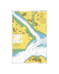
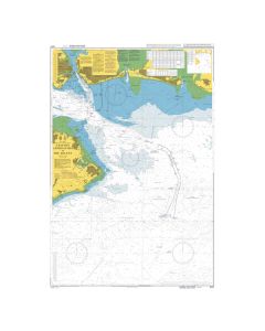
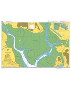
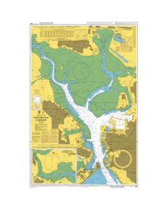
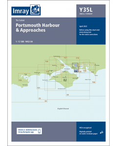
2200.5 Portsmouth Harbour & Approaches (1:12 500)
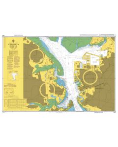
2200.6 Portsmouth Harbour - Northern Part (1:12 500)
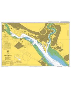
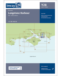
2200.7 Langstone Harbour (1:21 500)
Plan: Southsea Marina (1:15 000)
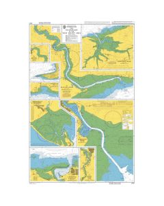
2200.8 Chichester Harbour (West) (1:21 500)
Plans: Northney Marina (1:12 500)
Emsworth Yacht Harbour (1:12 500)
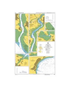
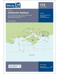
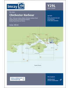
2200.9 Chichester Harbour (East) (1:21 500)
Plan: Birdham Pool & Chichester Marina (1:12 500)
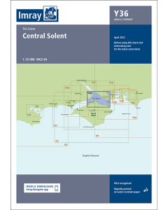
2200.10 Central Solent (1:35 000)
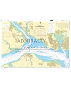
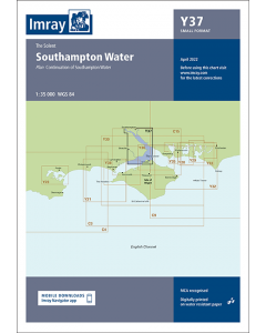
2200.11 Southampton Water (1:35 000)
Plan: Continuation of Southampton Water (1:35 000)
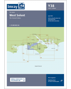
2200.12 West Solent (1:35 000)
Plan: Yarmouth Harbour (1:4500) 2200.13 Isle of Wight Plans
Plans: Bembridge Harbour & Approaches (1:10 000), Newtown River (1:20 000), Cowes & River Medina (1:7500), Continuation of River Medina (1:12 500)
2200.14 Isle of Wight and Solent Plans Plans: Wootton Creek (1:10 000), Ryde (1:20 000), Beaulieu River (1:20 000), Keyhaven (1:7500)
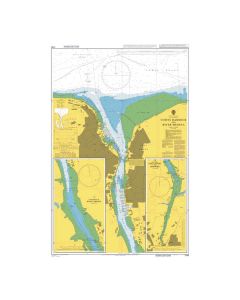
2200.15 River Itchen & Approaches (1:12 500)
2200.16 River Hamble (1:7500)
Imray Digital Charts: Includes mobile download
A voucher code to download the relevant Imray digital charts into our Imray Navigator app is included with this atlas.


![Eyeball Chart Plotter [Laminated] - The Solent](https://www.bookharbour.com/media/catalog/product/cache/f073062f50e48eb0f0998593e568d857/y/o/yot7065.jpg)

![NP255 - ADMIRALTY Tidal Stream Atlas: Falmouth to Padstow [including Isles of Scilly]](https://www.bookharbour.com/media/catalog/product/cache/f073062f50e48eb0f0998593e568d857/n/p/np255_1.jpg)