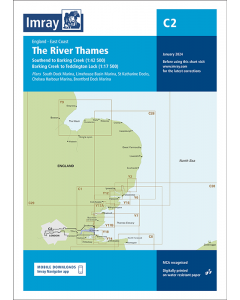
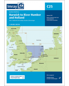
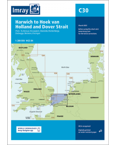
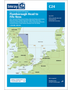
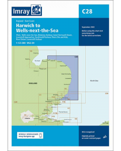
C2 The River Thames - Teddington to Southend (Imray Chart)

- FREE Delivery to UK - Spend over £75
- FREE Delivery to Europe - Spend over £150
- Worldwide Delivery Available
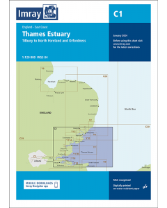
England East Coast Imray Chart
Product Details
Part Number: YOT0090
Scale: 1:2(Plans)
ISBN: 9781786795663
Publisher: Imray Laurie Norie And Wilson Ltd
Manufacturer: Imray Laurie Norie And Wilson Ltd
Edition: 2024
Printed and corrected to: January 2024
Format: Sheet size 787 x 1118mm. Waterproof. Folded in plastic wallet.
Language: English
MPN: ICC2-4
A navigation chart of the River Thames from Teddington to Southend in four panels:
Southend to Barking Creek (1:42 500)
Barking Creek to Vauxhall Bridge (1:17 500)
Vauxhall Bridge to Twickenham Bridge (1:17 500)
Twickenham Bridge to Teddington Lock (1:17 500)
Also includes marina plans:
South Dock Marina (1:5000)
Limehouse Basin Marina (1:5500)
St. Katharine Docks (1:5250)
Chelsea Harbour Marina (1:2750)
Brentford Dock Marina (1:3000)
This chart has been reschemed to provide coverage at a more consistent scale through the tidal River Thames, from Teddington Lock down river to Southend. The latest official UKHO data is included, combined with additional information sourced from Imray''s network to make it ideal for small craft. The chart has been fully revised throughout.

![East Coast Pilot [PRE-ORDER]](https://www.bookharbour.com/media/catalog/product/cache/f073062f50e48eb0f0998593e568d857/p/i/pil0030_1.jpg)