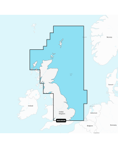
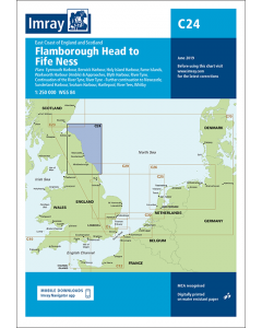
C24 Flamborough Head to Fife Ness (Imray Chart)

- FREE Delivery to UK - Spend over £75
- FREE Delivery to Europe - Spend over £150
- Worldwide Delivery Available
East Coast of England and Scotland Imray Chart.
Printed and corrected to February 2024
Product Details
Part Number: YOT0220
Scale: 1:250000
ISBN: 9781786790248
Publisher: Imray Laurie Norie And Wilson Ltd
Manufacturer: Imray Laurie Norie And Wilson Ltd
Edition: 2018
Printed and corrected to: February 2024
Format: Sheet size 787 x 1118mm. Waterproof. Folded in plastic wallet.
Language: English
MPN: ICC24-3
Passage chart of the east coast of England from Flamborough Head to Fife Ness. Five-minute gridlines. Scale 1:251,700. Larger scale plans of Holy Island harbour, Eyemouth, Berwick, Warkworth, River Tyne, Blyth, Seaham, Sunderland, Whitby, Hartlepool, River Tees and Scarborough. Tidal stream diagrams.

![East Coast Pilot [PRE-ORDER]](https://www.bookharbour.com/media/catalog/product/cache/f073062f50e48eb0f0998593e568d857/p/i/pil0030_1.jpg)