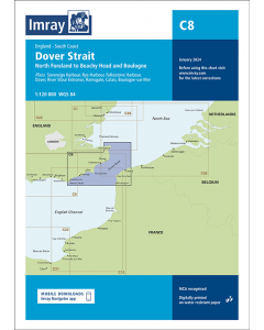
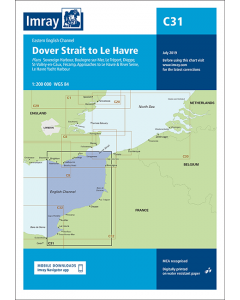
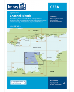
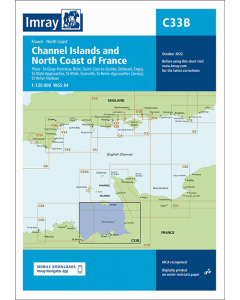
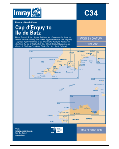
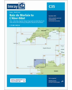
C8 Dover Strait - North Foreland to Beachy Head and Boulogne (Imray Chart)

- FREE Delivery to UK - Spend over £75
- FREE Delivery to Europe - Spend over £150
- Worldwide Delivery Available
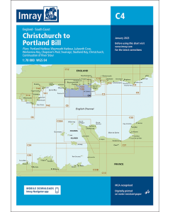
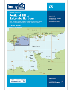
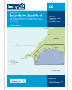
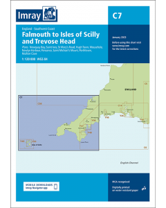
England South Coast Imray Chart.
Printed and corrected to January 2024.
Product Details
Part Number: YOT0150
Scale: 1:120000
ISBN: 9781786795595
Publisher: Imray Laurie Norie And Wilson Ltd
Manufacturer: Imray Laurie Norie And Wilson Ltd
Edition: 2024
Printed and corrected to: January 2024
Format: Sheet size 787 x 1118mm. Waterproof. Folded in plastic wallet.
Language: English
MPN: ICC8-6
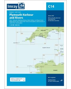
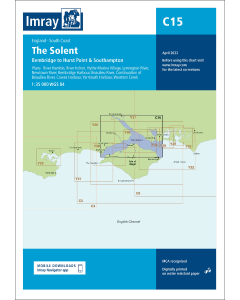
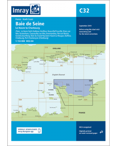
Plans included:
Sovereign Harbour (1:20 000)
Rye Harbour (1:35 000)
Folkestone Harbour (1:10 000)
Dover (1:15 000)
River Stour Entrance (1:35 000)
Ramsgate (1:6500)
Calais (1:20 000)
Boulogne-sur-Mer (1:25 000)
This edition includes the latest official UKHO data combined with additional information sourced from Imray's network to make it ideal for small craft. It includes the latest official bathymetric surveys. The latest harbour developments at Dover are included. The main chart has been rescaled to provide increased coverage. There has been general updating throughout.


![NP255 - ADMIRALTY Tidal Stream Atlas: Falmouth to Padstow [including Isles of Scilly]](https://www.bookharbour.com/media/catalog/product/cache/f073062f50e48eb0f0998593e568d857/n/p/np255_1.jpg)