Mediterranean Spain Pack

- FREE Delivery to UK - Spend over £75
- FREE Delivery to Europe - Spend over £150
- Worldwide Delivery Available
Mediterranean Spain pack includes Imray Mediterranean Spain Pilot Book and a Chart Atlas for the North, South or both.
Product Details
Part Number: PIL0089;YOT0868;YOT0869
Edition: No
Printed and corrected to: No
Publisher: Imray Laurie Norie And Wilson Ltd
Language: English
Format: No
Mediterranean Spain
This new volume replaces the current two part coverage of the Mediterranean mainland coast of Spain from Gibraltar to the French border.
The entire coverage has been revised with the text updated, new plans added and others updated from the latest information. There are numerous new photos to support the sailing directions.
This is the only detailed pilot for the Spanish Mediterranean coast running up from Gibraltar to the border with France. It covers a varied cruising area that includes the mountain-backed Costas del and Sol and Blanca, the expansive lagoon of the Mar Menor, the low lying Ebro delta and the rugged Costa Brava. In between are several great cities including Malaga, Valencia, Tarragona and Barcelona, the Catalan capital. The volume opens with Gibraltar and La LÃnea.
With Imray charts for the same coast Mediterranean Spain provides all the data necessary for anyone based in Spain, transitting to and from areas further East or the Balearics, or just exploring this rich and varied coast and its hinterland.
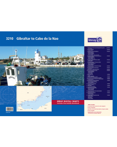
3210 Gibraltar to Cabo de la Nao
A brand new chart atlas covering Mediterranean Spain from Gibraltar to Cabo de la Nao.
Coverage includes passage through the Strait of Gibraltar – the gateway to the Mediterranean – and approach to Gibraltar itself, and details the coastal cruising along the Costa del Sol and Costa Blanca, as far as Jávea and Dénia just beyond Cabo de la Nao. This area includes the high coastal cliffs and good anchorages around Cabo de Gata, the low-lying inland sea of Mar Menor, and the many harbours and anchorages around the resorts that stretch up to Cabo de la Nao. The 21 sheets in the atlas provide all the necessary information for passage planning, coastal navigation and detailed approach to more than 100 recommended anchorages, harbours and marinas. In loose-leaf A2 format in a tough plastic wallet. Also available wiro-bound.
Imray Digital Charts: Free mobile download
A voucher code to download the relevant Imray digital charts into our Imray Navigator app is included with this atlas.
Charts included:
1. Mediterranean Spain South Passage Planning Chart (1:1 200 000) includes plan Isla de Alborán (1:20 000)
2. Strait of Gibraltar (1:150 000) includes plan Puerto de Ceuta (1:12 500)
3. Gibraltar to Punta de Calaburras (1:150 000) includes plans Puerto Sotogrande (1:10 000), Puerto de la Duquesa (1:7500), Puerto de la Estepona (1:10 000), Puerto José Banús (1:10 000) and Puerto de Marbella & Marina de Bajadilla (1:10 000)
4. Punta de Calaburras to Punta de la Mona (1:150 000) includes plans Puerto de Fuengirola (1:7500), Puerto de Benalmádena (1:7500), Puerto de Málaga (1:10 000), Puerto de Caleta de Vélez (1:10 000)
5. Punta de la Mona to Punta Los Baños (1:150 000) includes plans Puerto de Motril (1:12 500), Puerto de Adra (1:7500)
6. Punta de los Baños to Punta de la Polcra (1:150 000) includes plans Puerto de Almerimar (1:7500), Puerto de Roquetas de Mar (1:5000), Puerto de Aguadulce (1:5000), Puerto de Almería (1:15 000)
7. Punta de la Polacra to Punta de Calnegre (1:150 000) includes plan Puerto de Garrucha (1:10 000)
8. Punta de Calnegre to Mar Menor (1:150 000) includes plan Cabo de Palos (1:12 500)
9. Mar Menor to Cabo de las Huertas (1:150 000)
10. Cabo de las Huertas to Dénia (1:150 000) includes plans Puerto de Villajoyosa (1:12 500), Ensenada de Benidorm (1:50 000), Puerto de Jávea (1:12 500), Puerto de Dénia (1:12 500)
11. Bay of Gibraltar (1:50 000) and Gibraltar (1:15 000)
12. Nerja to Salobreña (1:50 000) includes plan Marina del Este (Puerto de la Mona) (1:7500)
13. Cabo de Gata to Ensenada De Los Escullos (1:50 000)
14. Punta de la Polcra to Punta de la Media Naranja (1:50 000) includes plan Puerto de San José (1:10 000)
15. Punta del Cano to Punta Calnegre (1:50 000) includes plans Puertos de Aguilas & El Hornillo (1:12 500), Punta de Calnegre to Cabo Tinoso (1:50 000), Puertos de Mazarrón (1:12 500)
16. Approaches to Cartagena (1:50 000) includes plan Puerto de Cartagena (1:15 000)
17. Mar Menor (1:50 000) includes plan Puerto de Tomás Maestre (1:15 000)
18. Approaches to Torrevieja (1:50 000) includes plans Puerto de Can Pedro Del Pinatar (1:7500), Puerto de la Horadada (1:7500), Puerto de Cabo Roig (1:7500), Puerto de Torrevieja (1:12 500)
19. Approaches to Santa Pola & Isla de Tabarca (1:50 000) includes plan Puerto de Santa Pola (1:10 000)
20. Approaches to Alicante (1:50 000) includes plans Puerto de Alicante (1:10 000), Puerto de Campello (1:5000)
21. Punta Del Albir to Cabo De La Nao (1:50 000) includes plans Puerto de Altea (1:12 500), Marina Greenwich (1:12 500), Puerto Blanco (1:12 500), Puerto de Calpe (1:12 500), Puerto de Moraira (1:7500)
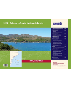
3220 Cabo de la Nao to the French border
A brand new chart atlas covering Mediterranean Spain from Cabo de la Nao to the French border.
This appealing cruising area stretches from Jávea and Dénia in the south, past the low-lying Ebro delta to the charming towns along the rugged Costa Brava in the north. It includes the cities of Valencia, Tarragona and Barcelona. The 23 sheets in the atlas provide all the necessary information for passage planning and detailed approaches to harbours, more than 150 recommended anchorages and marina contact details. In loose-leaf A2 format in a tough plastic wallet. Also available wiro-bound.
Imray Digital Charts: Free mobile download
A voucher code to download the relevant Imray digital charts into our Imray Navigator app is included with this atlas.
Charts included:
1. Mediterranean Spain North Passage Planning Chart (1:1 200 000)
2. Cabo de la Nao to Cabo Cullera (1:150 000) includes plans Puerto de Oliva (1:7500),
Puerto de Gandía (1:15 000) & Cabo Cullera Anchorages (1:50 000)
3. Cabo Cullera to Burriana (1:150 000)
4. Burriana to Cabo de Irta (1:150 000) includes plan Puerto de Burriana (1:10 000)
5. Cabo de Irta to Cabo Tortosa (1:150 000) includes plans Puerto de Peñíscola (1:12 500), Puerto de Benicarló (1:12 500) & Puerto de Vinaròs (1:12 500)
6. Cabo Tortosa to Cabo Gros (1:150 000) includes plans Puerto Deportivo de Sant Jordi d'Alfama (1:7500), Puerto de Calafat (1:7500), Puerto de Hospitalet de L'Infant (1:7500) & Puerto de Cambrils (1:7500)
7. Cabo Gros to Barcelona (1:150 000) includes plans Puerto de Vilanova i la Geltrú (1:10 000), Puerto de Aiguadolç (1:10 000), Puerto de Garraf (1:10 000) & Puerto de Ginesta (1:10 000)
8. Barcelona to Cabo de Tossa (1:150 000) includes plans Puerto de El Masnou (1:10 000), Puerto de Premià de Mar (1:10 000), Puerto de Mataró (1:10 000), Port Balís (1:10 000) & Puerto de Arenys de Mar (1:10 000)
9. Punta d'En Pau to Cap Cerbère (1:150 000)
10. Approaches to Jávea & Dénia (1:50 000) includes plans Puerto de Jávea (1:12 500) & Puerto de Dénia (1:12 500)
11. Approaches to Valencia (1:50 000) includes plans Puerto de Valencia - Yacht Harbour Real Club Náutico (1:15 000), Puerto de Valencia - Marina Real Juan Carlos I (1:15 000) & Puerto Saplaya (Puerto de Alboraya) (1:10 000)
12. Approaches to Sagunto (1:50 000) includes plans Pobla Marina (Puerto de Farnals) (1:10 000) & Puerto de Siles (1:7500)
13. Approaches to El Grao de Castellón (1:50 000) includes plans Puerto de Castellón de la Plana (1:15000) & Puerto Oropesa del Mar (1:10 000)
14. Islotes Columbretes (1:12 500)
15. Bahía des Alfacs (1:50 000) includes plans Puerto de les Cases d'Alcanar (Casas de Alcanar) (1:12 500) & Puerto de Sant Carles de la Ràpita (1:12 500)
16. Ebro Delta (1:50 000) and Golfo de L’Ampolla (1:50 000) includes plans Puerto L'Ampolla (1:12 500), Puerto de L'Estany Gras & Puerto de L'Ametlla de Mar (1:15 000)
17. Approaches to Tarragona (1:50 000) includes plans Puerto de Salou (1:10 000), Cabo Salou Anchorages (1:15 000), Tarragona - Port Esportiu Marina (1:10 000) & Puerto de Torredembarra (1:10 000)
18. Approaches to Barcelona (1:50 000) includes plans Marina Port Vell (1:12 500), Puerto Olimpico (1:10 000), Port Forum (1:10 000) & Marina Badalona (1:10 000)
19. Punta de la Tordera to Punta d'En Pau (1:50 000) includes plans Puerto de Blanes & Anchorages to the North East (1:10 000), Puerto de Cala Canyelles & Anchorages to the West (1:10 000) & Sant Feliu de Guíxols (1:10 000)
20. Punta d'En Pau to Cap Negre (1:50 000) includes plans Port d'Aro (1:12 500), Puertos de Palamós (1:12 500), Cala Seniá to Cabo Roig & Freu de las Hormigas (1:10 000), Calella de Palafrugell & Puerto de Llafranc (1:10 000) & Calas de Aiguablava & Fornells (1:10 000)
21. Cap Negre to Golfo de Roses (1:50 000) includes plans Puerto de L'Estartit & Las Islas Médas (1:15 000) & Puerto de L'Escala (1:12 500)
22. Golfo de Roses to Cadaqués (1:50 000) and Bahia de Roses (1:15 000)
23. Cadaqués to Cap Cerbère (1:50 000) includes plans Puerto de Cadaqués (1:20 000),
Puerto de la Selva (1:10 000), Puerto de Llançà (1:10 000), Puerto de Colera (1:10 000) & Puerto de Portbou (1:10 000)