SC5606 Thames Estuary, Ramsgate to Tower Bridge

- FREE Delivery to UK - Spend over £75
- FREE Delivery to Europe - Spend over £150
- Worldwide Delivery Available
WITHDRAWN - REPLACED BY INDIVIDUAL SHEETS
ADMIRALTY Leisure Small Craft Chart Folio covering Thames Estuary - Ramsgate to Canvey Island
Product Details
Part Number: SC5606
Scale: 1:1(Various)
ISBN: 9780707781365
Publisher: UK Hydrographic Office
Edition: 2021
Printed and corrected to: edition date
Format: Folio - A2 Size
Language: English
MPN: SC5606
Thames Estuary - Ramsgate to Canvey Island
Charts included:
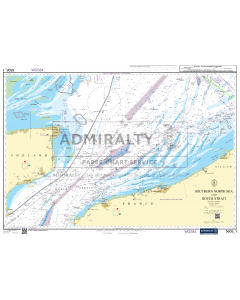
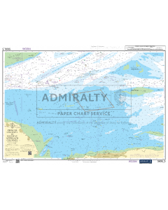
- 5606.1 Southern North Sea and Dover Strait. 1:250,000
- 5606.2 Southern Thames Estuary. 1:100,000
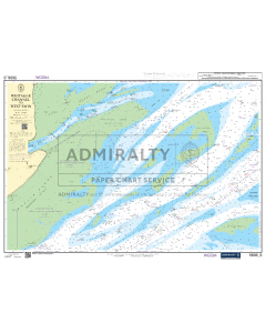
- 5606.3 Dover to Ramsgate including Sandettié Bank. 1:75,000
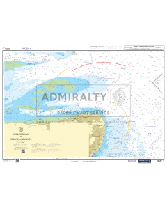
- 5606.4 Gull Stream to Princes Channel. 1:50,000
- 5606.5 Princes Channel to Medway Approach Channel. 1:50,000
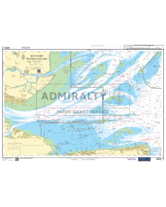
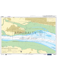
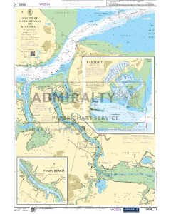
- 5606.6 Whitaker Channel to West Swin. 1:50,000
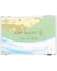
- 5606.7 Havengore Bridge to Southend-on-Sea. 1:25,000
- 5606.8 Southend-on-Sea to Canvey Island. 1:25,000
- 5606.9 Medway Approach Channel. 1:25,000
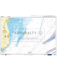
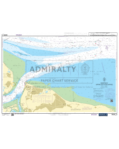
- 5606.10 A - Mouth of River Medway and West Swale. 1:25,000
B - The Swale - Ferry Reach. 1:12,500
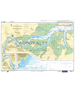
C - Ramsgate. 1:5,000 - 5606.11 A - River Medway - Saltpan Reach to Chatham Reach. 1:25,000
B - River Medway – Rochester. 1:12,500
C - Approaches to Ramsgate. 1:12,500 - 5606.12 A - The Swale - Shell Ness to Conyer Creek. 1:25,000
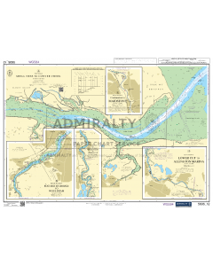
B - River Medway - Rochester Bridge to Wouldham. 1:25,000
C - River Medway - Wouldham to Lower Cut. 1:25,000
D - River Medway - Lower Cut to Allington Marina. 1:25,000
E - River Medway – Continuation to Maidstone. 1:25,000