SC5613 Irish Sea - Eastern Part

- FREE Delivery to UK - Spend over £75
- FREE Delivery to Europe - Spend over £150
- Worldwide Delivery Available
WITHDRAWN - REPLACED BY INDIVIDUAL SHEETS
4th Edition, 2020
ADMIRALTY Leisure Small Craft Chart Folio for the eastern part of the Irish Sea
Product Details
Part Number: SC5613
Scale: 1:1(Various)
ISBN: 9780707781068
Publisher: UK Hydrographic Office
Edition: 2020
Printed and corrected to: edition date
Format: Folio - A2 Size
Language: English
MPN: 9780707781068
SC5613 - Irea Sea - Eastern Part
Charts included:
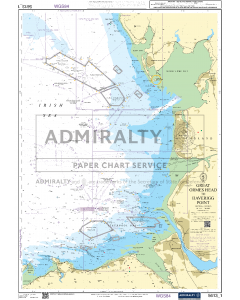
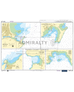
- 5613.1 - Great Ormes Head to Haverigg Point
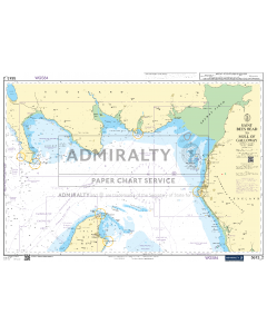
- 5613.2 - Saint Bees Head to Mull of Galloway
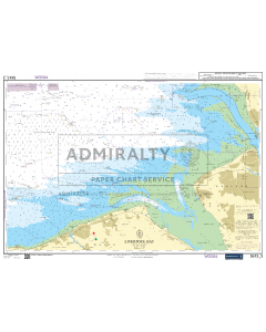
- 5613.3 - Liverpool Bay
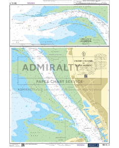
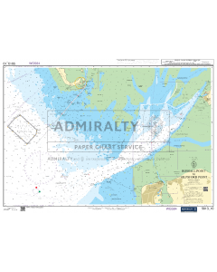
- 5613.4 - Approach to Liverpool
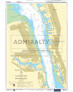
- 5613.5 - River Mersey - Gladstone Dock to Brunswick Dock
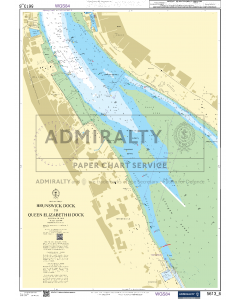
- 5613.6 - River Mersey - Brunswick Dock to Queen Elizabeth II Dock
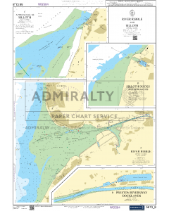
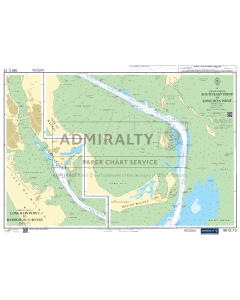
- 5613.8 - River Ribble and Silloth
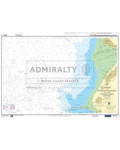
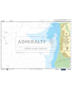
- 5613.9 - Lytham Saint Annes to Fleetwood including South Morecambe Gas Field
- 5613.10 - Irish Sea - Eastern Part
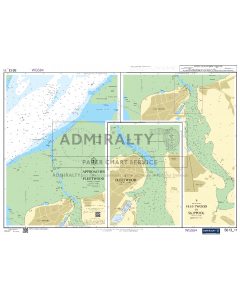
- 5613.11 - Approaches to Fleetwood
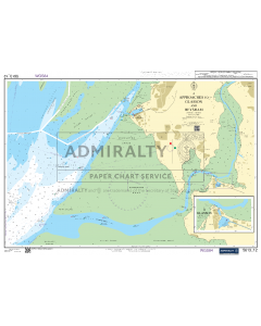
- 5613.12 - Approaches to Glasson and Heysham
- 5613.13 - Barrow Harbour - South East Point to Long Rein Point
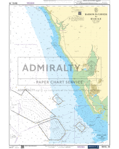
- 5613.14 - Barrow-in-Furness to Seascale
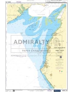
- 5613.15 - Saint Bees Head to Abbey Head
- 5613.16 - Harbours on the Cumbrian Coast
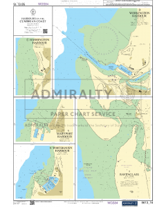
- 5613.17 - Workington to Isle of Whithorn
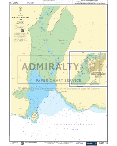
- 5613.18 - Kircudbright Bay
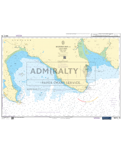
- 5613.19 - Wigtown Bay to Luce Bay
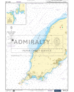
- 5613.20 - Isle of Man - West Coast
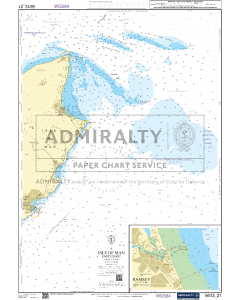
- 5613.21 - Isle of Man - East Coast
- 5613.22 - Ports and Harbours in Isle of Man
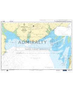
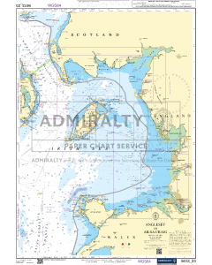
- 5613.23 - Anglesey to Ailsa Craig

![NP255 - ADMIRALTY Tidal Stream Atlas: Falmouth to Padstow [including Isles of Scilly]](https://www.bookharbour.com/media/catalog/product/cache/f073062f50e48eb0f0998593e568d857/n/p/np255_1.jpg)