West Country Pack

- FREE Delivery to UK - Spend over £75
- FREE Delivery to Europe - Spend over £150
- Worldwide Delivery Available
Pack includes The West Country Pilot Book & 2400 West Country Atlas
Product Details
Part Number: PIL0480;YOT0854
Edition: No
Printed and corrected to: No
Publisher: Imray Laurie Norie And Wilson Ltd
Language: English
Format: No
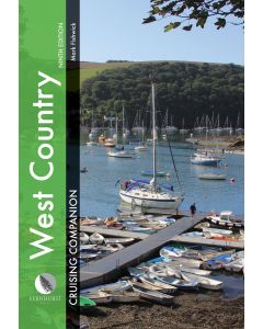
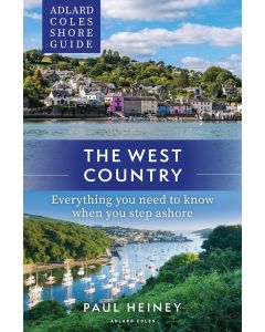
The West Country
The West Country is a cruising guide covering Lyme Bay to Land’s End and the Isles of Scilly. It provides essential sailing directions and detailed listings of facilities together with a wealth of information for those wishing to learn about the West Country and enjoy trips ashore. Part of the coastline has World Heritage Status and its geological history is described. Human settlement is traced and the reader is given guidance to find the oldest European fossil of modern man and numerous bronze age remains. Seahorses, dolphins, birds and flowers are discussed as is the history of the cream tea, which comes with a recipe for scones! People of significance, who were born or moved here, such as Sir Francis Drake, William Cookworthy and Agatha Christie, are also included, together with information on the atmospheric railway, the mining and fishing industry and, of course, the Cornish pasty.
All the information relevant to a passage, harbour or anchorage is arranged for easy access. Aerial photographs have been taken by Patrick Roach. Ordnance Survey road maps and larger scale town plans help pinpoint facilities ashore.
The West Country and Imray charts for the southwest of England provide a comprehensive package for all visitors arriving by boat.
Carlos Rojas wrote Imray's Cruising Galicia with Robert Bailey. Along with Imray and through his company Tucabo he has released marine apps for the iPhone and iPad, including Tides, Rules & Signals, Racing Rules, Boat Handling and Chart Navigation using Imray charts.
2400 West Country Atlas
A convenient A2 format chart pack of The West Country provided in a sturdy plastic wallet.
This fully revised edition of our popular 2400 West Country chart pack includes the latest official UKHO data, combined with additional information sourced from Imray's network to make it ideal for small craft.
The chart pack includes all the navigational charts and tidal data for passage, approach and mooring.
2400.1 Land’s End to Trevose Head
1: 180 000 WGS 84
Includes plans Newquay Bay (1:10 000) and Saint Ives (1:15 000)
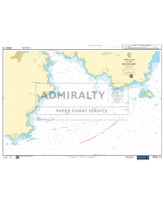
2400.2 Approaches to the Isles of Scilly
1: 120 000 WGS 84
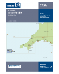
2400.3 Isles of Scilly
1: 40 000 WGS 84
Includes plan St Mary’s Road (1:25 000)
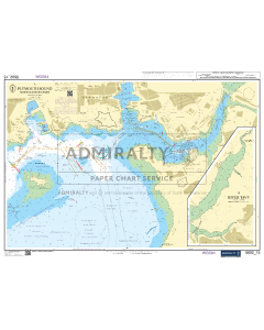
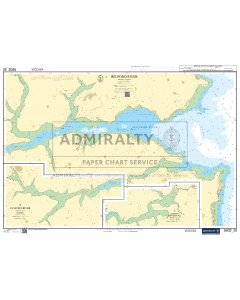
2400.4 River Camel
1: 30 000 WGS 84
Includes plan Padstow Harbour (1:10 000)
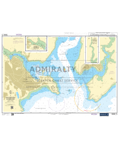
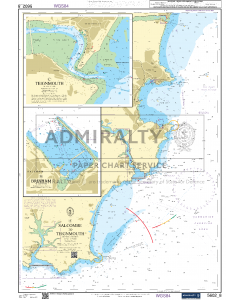
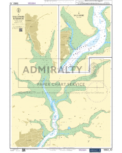
2400.5 Salcombe Harbour
1: 15 000 WGS 84
Includes plan Salcombe (1:9000)
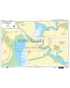
2400.6 River Yealm
1: 12 500 WGS 84
Includes plan Continuation of River Yealm (1:15 000)
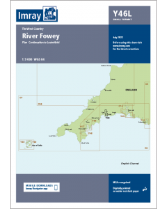
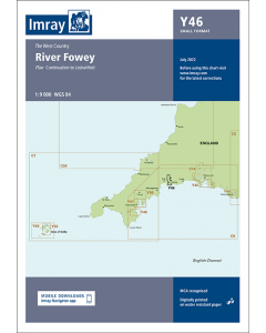
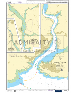
2400.7 River Fowey
1: 9000 WGS 84
Includes plan Continuation to Lostwithiel (1:20 000)
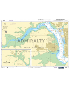
2400.8 Dartmouth to Fowey
1: 150 000 WGS 84
Includes plans Polperro (1:3500) and Looe (1:10 000)
2400.9 Fowey to Lizard Point
1: 110 000 WGS 84
Includes plans Mevagissey Harbour (1:3500) and Gorran Haven (1:30 000)
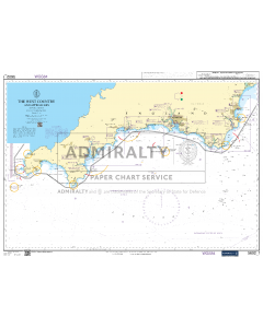
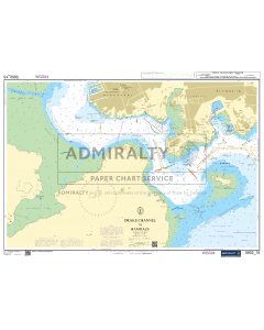
2400.10 Lizard Point to Land’s End
1: 75 000 WGS 84
Includes plans Penzance (1:12 000), Newlyn Harbour (1:10 000) and Mousehole (1:5000)
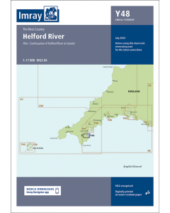
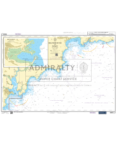
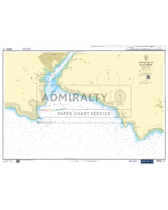
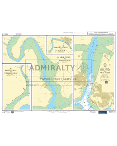
2400.11 Helford River
1: 17 000 WGS 84
Includes plan Continuation of Helford River to Gweek (1:17 000)
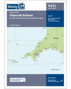
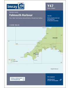
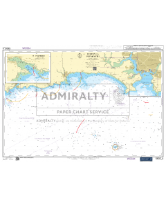
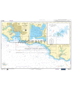
2400.12 Falmouth Harbour
1: 20 000 WGS 84
Includes plans Mylor Yacht Harbour (1:10 000), Falmouth Marina (1:5000) and Falmouth Inner Harbour (1:10 000)
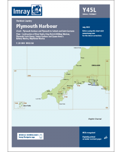
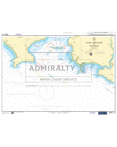
2400.13 Plymouth Harbour
1: 20 000 WGS 84
Includes plans King Point & Millbay Marinas (1:10 000) and Continuation of River Yealm (1:20 000)
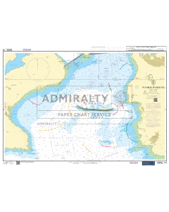
2400.14 Plymouth to Saltash and Saint Germans
1: 20 000 WGS 84
Includes plans Mayflower Marina (1:5000), Sutton Harbour and Queen Anne’s Battery Marina (1:7500) and Plymouth Yacht Haven (1:5000)
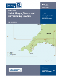
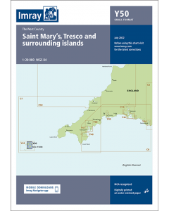
2400.15 Saint Mary’s, Tresco and Surrounding Islands
1: 20 000 WGS 84
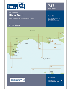
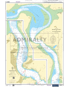
2400.16 River Dart
1: 15 000 WGS 84
Plans Kingswear, Continuation to Totnes
Various individual sheets of this chart pack are available separately. These form part of our ‘small format Y chart series’ that mirror coverage of charts from the corresponding atlas and printed A2 size. For details of these please see their individual web page (Y43, Y44, Y45, Y46, Y47, Y48, Y49 and Y50).
A voucher code to download ID20 Imray English Channel charts into Imray Navigator (Imray app for iPad, iPhone and Android) is included with this chart pack.