East Coast Pack

- FREE Delivery to UK - Spend over £75
- FREE Delivery to Europe - Spend over £150
- Worldwide Delivery Available
This pack includes Imray's East Coast Pilot and either the Atlas for Suffolk & Essex or Kent & Sussex, or both.
Product Details
Part Number: PIL0030;YOT0850;YOT0851
Edition: No
Printed and corrected to: No
Publisher: Imray Laurie Norie And Wilson Ltd
Language: English
Format: No
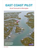
East Coast Pilot
East Coast Pilot has become the bible for cruising sailors for the waters between Great Yarmouth and Ramsgate. Not only does it cover the many harbours, rivers and creeks in a clear and concise manner, it also reveals some of the mysteries of sailing these shallow and shifting coastal waters. Both authors keep their boats on the East Coast and are life-long lovers of the area. They maintain that every time they cast off and take to the water, they learn something new, adding to the considerable wealth of experience which they have passed on enthusiastically over many years.
For clarity and ease of reference the book is laid out in a logical sequence- each estuary, river and port has its own chapter which starts with the key information to get you in to that chosen destination. Box panels give key waypoints, port and harbour contact details, plus information about the main boating facilities a crew could need. Further pages will entice you in as far as the limit of navigation. Essential information is backed up by Imray cartography, the authors’ own sea-level photography giving you a clear view of what you should see, and aerial photographs which offer a useful visual perspective on what lies ahead.
Unique to East Coast Pilot are ‘rolling road’ diagrams to guide the approach. These were introduced to great acclaim in the first edition and show buoyage sequences and tracks to steer into rivers and ports.
2000 Suffolk & Essex Coasts
The pack includes:
A convenient A2 format chart pack of Suffolk and Essex Coasts covering the waters from the River Crouch to Lowestoft. The pack is provided in a sturdy plastic wallet.
This fully revised and extended edition of our popular 2000 Suffolk and Essex Coasts chart pack has been redesigned and expanded to 11 sheets, including improved coverage of Lowestoft and its approaches.
The latest official UKHO data has been used and combined with additional information sourced from Imray's network to make it ideal for small craft. The chart pack includes all the navigational charts and tidal data for passage, approach, and mooring, and is designed to be used alongside East Coast Pilot by Garth Cooper and Dick Holness.
2000.1 Foulness Point to Harwich (1:120 000)
2000.2 Rivers Ore and Alde (1:35 000)
2000.3 River Deben and Orford Haven (1:35 000)
Plan: Woodbridge (1:15 000)
2000.4 Harwich Approaches and Walton Backwaters (1:35 000)
Plan: Titchmarsh Marina (1:12 500)
2000.5 Rivers Stour and Orwell (1:35 000)
Plans: Upper Orwell to Ipswich (1:20 000), Fox’s Marina (1:10 000), Woolverstone Marina (1:10 000), Suffolk Yacht Harbour (1:15 000), Shotley Marina (1:10 000)
2000.6 River Blackwater (1:35 000)
Plans: Maldon (1:20 000), Tollesbury Marina (1:12 500), Bradwell Marina (1:12 500)
2000.7 River Colne (1:35 000)
Plans: Wivenhoe (1:20 000), Brightlingsea (1:15 000)
2000.8 River Crouch Entrance (1:35 000)
2000.9 Rivers Crouch & Roach (1:35 000)
Plans: Burnham Yacht Harbour (1:12 500), River Crouch continuation to Battlesbridge (1:35 000)
2000.10 Harwich to Lowestoft (1:125 000)
Plan: Southwold Harbour (1:12 500)
2000.11 Lowestoft Approaches (1:35 000)
Plan: Lowestoft Harbour (1:10 000)
2100 Kent and Sussex Coasts
A handy-sized A2 pack of charts covering the Kent and Sussex coasts.
This fully revised and extended edition includes the latest official UKHO data combined with additional information sourced from Imray's network to make it ideal for small craft.
It includes 5 extra chart sheets and incorporates all the latest official bathymetric surveys. The latest harbour developments at Dover and Calais are also included. The plan of The Looe has had a scale increase to provide larger scale coverage. Passage planning sheets are now at a uniform scale of 1:120 000 and coverage extends as far West as the Isle of Wight. Coverage of The Swale has increased to 1:20 000 and split over two sheets.
An additional chart has been added showing large scale coverage of the River Swale approaches from the East and a new harbour plan of Swale Marina has been added. Coverage of the River Medway is now at a scale of 1:20 000 giving twice as much chart detail than previously shown, this increased scale continues all the way to Allington Lock.
Larger scale coverage of the River Thames from Barking Creek to Tower Bridge is also included. There has been general updating throughout.
2100.1 Thames Estuary South
1: 120 000 WGS 84
2100.2 River Thames Sea Reach
1: 50 000 WGS 84
2100.3 The River Thames - Queen Elizabeth Bridge to Canvey Island
1: 35 000 WGS 84
Plans Coalhouse Point to Canvey Island, Queen Elizabeth II Bridge to Coalhouse Point
2100.4 The River Thames - Tower Bridge to Queen Elizabeth Bridge
1: 35 000 WGS 84
Plans Barking Creek to Queen Elizabeth II Bridge, Tower Bridge to Barking Creek
2100.5 River Medway
1: 40 000 WGS 84
Plans Gillingham Marina, Port Werburgh, Whitton Marine, Continuation of River Medway
2100.6 The Swale
1: 40 000 WGS 84
Plans Whitstable Harbour
2100.7 North Foreland to Dover & Calais
1: 115 000 WGS 84
2100.8 Dover to Dungeness & Cap Gris-Nez
1: 115 000 WGS 84
2100.9 Beachy Head to Dungeness
1: 115 000 WGS 84
Plans Sovereign Harbour, Rye Harbour
2100.10 Nab Tower to Beachy Head
1: 160 000 WGS 84
2100.11 Kent Plans - including plan of Calais
1: various WGS 84
Plans Ramsgate, River Stour Entrance, Dover, Calais, Folkestone
2100.12 Sussex Plans
1: various WGS 84
Plans Newhaven, Brighton Marina, Shoreham Harbour, Littlehampton, The Looe