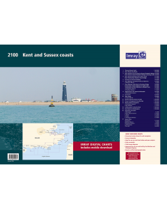
2100 Kent and Sussex Coasts Chart Pack

- FREE Delivery to UK - Spend over £75
- FREE Delivery to Europe - Spend over £150
- Worldwide Delivery Available
Thames Estuary to the Solent
Product Details
Part Number: YOT0851
Scale: 1:1(Various)
ISBN: 9781786795571
Publisher: Imray Laurie Norie And Wilson Ltd
Edition: 2024
Printed and corrected to: January 2024
Format: Folio - A2 Size
Language: English
MPN: IC2100-8
A handy-sized A2 pack of charts covering the Kent and Sussex coasts.
This fully revised edition includes the latest official UKHO data combined with additional information sourced from Imray''s network to make it ideal for small craft.
2100.1
Thames Estuary South (1:120 000)
2100.2
River Thames Sea Reach (1:42 500)
2100.3
River Thames - Canvey Island to Queen Elizabeth II Bridge (1:42 500)
River Thames - Queen Elizabeth II Bridge to Barking Creek (1:42 500)
2100.4
River Thames - Barking Creek to Bow Creek (1:17 500)
River Thames - Bow Creek to Tower Bridge (1:17 500)
2100.5
Entrance to the River Medway (1:20 000)
2100.6 River Medway: Horseshoe Point to Folly Point (1:20 000)
Plan Whitton Marine (1:6000)
2100.7
River Medway: Folly Point to Rochester Bridge (1:20 000)
Continuation of River Medway to Holborough (1:25 000)
Continuation of River Medway to Allington Lock (1:25 000)
Plans Gillingham Marina (1:10 000), Chatham Marina (1:10 000)
2100.8
Approaches to The Swale & Whitstable (1:42 500)
Plan Whitstable Harbour (1:7000)
2100.9
East Swale (1:20 000)
2100.10 West Swale (1:20 000)
Plan Swale Marina (1:7500)
2100.11
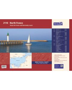
North Foreland to Dover & Calais (1:120 000)
2100.12
Dover to Dungeness & Cap Gris-Nez (1:120 000)
2100.13
Beachy Head to Dungeness (1:120 000)
Plans Sovereign Harbour (1:20 000), Rye Harbour (1:35 000) 2100.14 Littlehampton to Beachy Head (1:120 000)
2100.15
East Solent to Littlehampton (1:120 000)
2100.16
Plans Ramsgate (1:6500), River Stour Entrance (1:35 000), Dover (1:15 000), Calais (1:20 000), Folkestone Harbour (1:10 000)
2100.17
Plans Newhaven (1:16 500), Brighton Marina (1:8500), Shoreham Harbour (1:20 000), Littlehampton (1:13 500), The Looe (1:60 000)
Imray Digital Charts: Free mobile download A voucher code to download the relevant Imray digital charts into the Imray Navigator app is included with this atlas.

![NP255 - ADMIRALTY Tidal Stream Atlas: Falmouth to Padstow [including Isles of Scilly]](https://www.bookharbour.com/media/catalog/product/cache/f073062f50e48eb0f0998593e568d857/n/p/np255_1.jpg)
![Channel Havens: Secret Inlets & Secluded Anchorages of the Channel [BACKORDER]](https://www.bookharbour.com/media/catalog/product/cache/f073062f50e48eb0f0998593e568d857/p/i/pil0580.jpg)