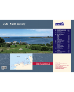
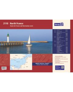
2510 North Brittany Chart Pack

- FREE Delivery to UK - Spend over £75
- FREE Delivery to Europe - Spend over £150
- Worldwide Delivery Available
Imray 2000 Series Folio for North Brittany
Product Details
Part Number: YOT0861
Scale: 1:1(Various)
ISBN: 9781786791597
Publisher: Imray Laurie Norie And Wilson Ltd
Edition: 2020
Printed and corrected to: January 2020
Format: Folio - A2 Size
MPN: 9781786791597
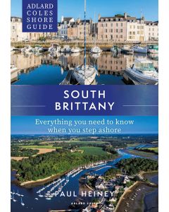
2510.1 The Channel Islands, Cherbourg Peninsula & North Brittany
1: 550 000 WGS 84
2510.2 Approaches to St-Malo & St-Cast-le-Guildo
1: 120 000 WGS 84
2510.3 Cap Fréhel to Paimpol
1: 110 000 WGS 84
Plans Rade de Portrieux (1:50 000), Chenal d’Erquy (1:50 000)
2510.4 Roches Douvres to Rivière de Tréguier & St-Quay-Portrieux
1: 110 000 WGS 84
2510.5 Approaches to Rivière de Trieux & Paimpol
1: 50 000 WGS 84
2510.6 Plans – St-Malo to Lézardrieux
1: various WGS 84
Plans St-Malo Approaches (1:55 000), St-Malo (1:17 500), Saint-Cast-Le-Guildo (1:20 000), Erquy (1:20 000), Dahouët (1:10 000), Port du Légué (1:20 000), Binic (1:12 500), St-Quay-Portrieux (1:25 000), Paimpol (1:15 000), Port de la Corderie (Île de Bréhat) (1:15 000), Port Clos (Île de Bréhat) (1:10 000), Lézardrieux (1:15 000)
2510.7 Approaches to Rivière de Tréguier
1: 35 000 WGS 84
Plans Tréguier (1:15 000)
2510.8 Les Héux de Bréhat to Primel
1: 110 000 WGS 84
2510.9 Baie de Morlaix
1: 50 000 WGS 84
Plans Primel (1:15 000), Port de Morlaix (1:15 000)
2510.10 Plans – Tréguier to Île de Batz
1: various WGS 84
Plans Port-Blanc (1:25 000), Anse de Perros (1:30 000), Ploumanac’h (1:10 000), Approaches to Trébeurden (1:35 000), Le Léguer (1:42 500), Canal de l’Île de Batz to Roscoff (1:20 000)
2510.11 Île de Batz to Île Vierge
1: 75 000 WGS 84
Plans Moguériec (1:32 000), Port du Pontusval (1:25 000)
2510.12 L’Aber Wrac’h to Argenton
1: 40 000 WGS 84
Plans Argenton (1:25 000)
2510.13 Île Vierge to Rade de Brest
1: 100 000 WGS 84
Plans L’Aber-Ildut (1:25 000), Port du Conquet (1:20 000)
2510.14 Le Four to St Mathieu & Île d’Oussant
1: 80 000 WGS 84
Plans Baie de Lampaul (Ouessant) (1:30 000), Baie du Stiff (Ouessant) (1:30 000)
On this edition the latest depth surveys have been applied. A tidal stream page has been added along with updated tidal data and contact details of harbours, marinas and coastguard stations. There has been general updating throughout.
Imray Digital Charts: Free mobile download
A voucher code to download the relevant Imray digital charts into Imray Navigator (our app for iPad, iPhone and Android) is included with this pack.

![NP255 - ADMIRALTY Tidal Stream Atlas: Falmouth to Padstow [including Isles of Scilly]](https://www.bookharbour.com/media/catalog/product/cache/f073062f50e48eb0f0998593e568d857/n/p/np255_1.jpg)