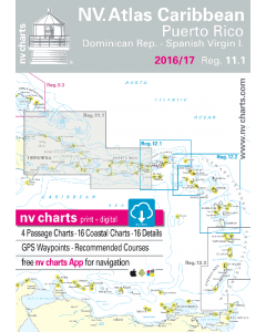
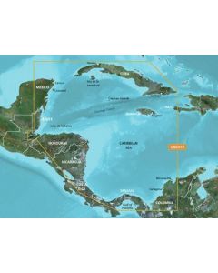
Reg. 11.1: NV.Atlas Caribbean - Puerto Rico (Dominincan Republic & Spanish Virgin Islands)

- FREE Delivery to UK - Spend over £75
- FREE Delivery to Europe - Spend over £150
- Worldwide Delivery Available
This atlas contains a download code for all charts in this area to be used with the nv chart app. The app is compatible with Apple: iOS/MacOSX, Android & Windows: 7/8/10.
Product Details
Part Number: YOT3553
Scale: 1:1(Various)
ISBN: 9783932414107
Publisher: NV Charts
Edition: 2022
Printed and corrected to: No
Format: No
MPN: 9783932414107
Includes:
- 5 Passage Charts
- 15 Coastel Charts & 17 Details
- Charts Paper and digital
- Digital Details & Photos of Harbors and Anchorages
The nv-charts are characterised by fine contours and easy to distinguish colour graduations of the depth lines – turquoise for coral reefs, red for the 2-meter-line and blue for the 5-m-areas.
Presented in a handy, user friendly size, (23½’’ x 16 ½’’) a thick plastic envelope protects the charts, enabling them to be easily stored.
The importance of good graphical representation of the topography when sailing in the Caribbean is essential.
Well marked rivers, towns and street plans all help to give a clear overall view of the shoreside facilities of the islands. Red numbered waypoints with coordinates based on WGS 84 enable yachtsmen to navigate using their GPS instruments. Heights and depths are given in the internationally accepted format of meters. Large scale approaches and land contour markings simplify the entrance into anchorages.