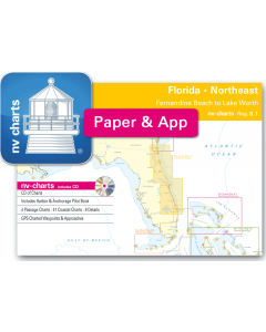
Reg. 8.1: NV.Atlas Florida - North (Fernandina Beach to St. Augustine)

- FREE Delivery to UK - Spend over £75
- FREE Delivery to Europe - Spend over £150
- Worldwide Delivery Available
This atlas contains a download code for all charts in this area to be used with the nv chart app. The app is compatible with Apple: iOS/MacOSX, Android & Windows: 7/8/10.
Product Details
Part Number: YOT3567
Scale: 1:1(Various)
Publisher: NV Charts
Edition: 2016
Printed and corrected to: No
Format: No
- CD of Charts
- Includes Harbour & Anchorage Pilot Book
- 4 Passage Charts - 41 Coastal Charts - 8 Details
- GPS Charted Waypoints - Approaches
Practical to use and accurate in the information and data published: This is the basic concept with which NV-Charts have developed the charts and the Harbour & Anchorage Pilot Books.
- this Chart Kit is based on NOAA data with a new layout, clear cartography and international chart standards
- depths and heights are charted in feet
- north up chart orientation
- channel markers in red and green
- unique color differences, blue for the 6 ft and 18 ft dephts, and green for exposed tidal areas
- contour lines for 12 ft and 30ft depths
- under water reefs are clearly marked with a light green color and the reef above water in darker green
- variable shoals marked in grey-blue
- lighthouses illustrate their light characteristics for better identification
- seaworthy chart layout - perfect chart flow from one chart to the next
- standardized chart scales - passage charts 1:340,000 coastal charts 1:40,000 and detail charts 1:20,000 or less
- waypoints with latitudes and longitudes for GPS input
- recommended courses with distances
- arrow-symbols show buoyage direction
- tide information on each chart
Passage Charts
C 1 Florida North 1: 1,300,000
C 2 Brunswick to St. Augustine 1: 340,000
C 3 St. Augustine to Cape Canaveral 1: 340,000
C 4 Cape Canaveral to Lake Worth Inlet 1: 340,000
Coastal Charts
C 5 St. Marys Entrance · Fernandia Beach 1: 40,000
C 6 Fernandina Beach to Nassau River 1: 40,000
C 7 Nassau River to St. Johns River 1: 40,000
C 8 St. Johns River to 202 Rd. Bridge 1: 40,000
C 9 202 Rd. Bridge to Pine Island 1: 40,000
C 10 Pine Island to St. Augustine 1: 40,000
C 11 St. Augustine to Cescent Beach 1: 40,000
C 12 Crescent Beach to Pine Cove 1: 40,000
C 13 Palm Coast to Halifax Creek 1: 40,000
C 14 Halifax Creek to Daytona Beach 1: 40,000
C 15 Daytona Beach to Ponce de Leon Inlet 1: 40,000
C 16 Ponce de Leon Inlet to Indian River North 1: 40,000
C 17 Indian River · Haulover Canal 1: 40,000
C 18 Haulover Canal to Addison Pt. Bridge 1: 40,000
C 19 Addison Pt. Bridge to Cocoa 1: 40,000
C 20 Indian River Cocoa to Sherwood Park 1: 40,000
C 21 Merritt Island North East 1: 40,000
C 22 Banana River · Cape Canaveral 1: 40,000
C 23 Indian River · Sherwood Park to Melbourne Shores 1: 40,000
C 24 Indian River · Melbourne Shores to Roseland 1: 40,000
C 25 Indian River · Roseland to Vero Beach 1: 40,000
C 26 Indian River · Vero Beach to Ft. Pierce 1: 40,000
C 27 Indian River · Ft. Pierce to Port St. Lucie 1: 40,000
C 28 St. Lucie · Stuart to Jupiter Narrows 1: 40,000
C 29 Jupiter Narrows to Jupiter Inlet 1: 40,000
C 30 Jupiter Inlet to Lake Worth Inlet 1: 40,000
C 31 Jacksonville 1: 40,000
C 32 Jacksonville South 1: 40,000
C 33 Fleming Islands 1: 40,000
C 34 Green Cove Springs 1: 40,000
C 35 Bridgeport 1: 40,000
C 36 Palatka 1: 40,000
C 37 Crescent Lake 1: 40,000
C 38 Welaka to Lake George 1: 40,000
C 39 Lake George 1: 40,000
C 40 Volusia · Lake Dexter 1: 40,000
C 41 Deltona · Lake Monroe 1: 40,000
C 42 Lake Jesup · Lake Harney 1: 40,000
C 43 St. Lucie Canal - Lake Okeechobee 1: 100,000
C 44 Lake Okeechobee North 1: 100,000
C 45 Lake Okeechobee South 1: 100,000
Details
C 46A/B Canaveral Barge Channel 1: 15,000
C 47 A St. Johns River Entrance 1: 20,000
C 47 B St. Augustine 1: 20,000
C 48 A Daytona Beach 1: 15,000
C 48 B Fort Pierce Inlet 1: 15,000
C 49 A Jupiter Inlet 1: 20,000
C 49 B St. Lucie Inlet 1: 20,000
C 50 Singer Island 1: 20,000