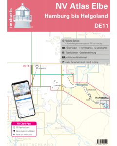
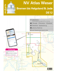
DE 12: NV Atlas Weser - Bremen bis Helgoland & Jade

- FREE Delivery to UK - Spend over £75
- FREE Delivery to Europe - Spend over £150
- Worldwide Delivery Available
This atlas contains a download code for all charts in this area to be used with the nv chart app. The app is compatible with Apple: iOS/MacOSX, Android & Windows: 7/8/10.
Product Details
Part Number: YOT0006DE12
Scale: 1:1(Various)
ISBN: 9783945902127
Publisher: NV Charts
Edition: 2024
Printed and corrected to: edition date
Format: Combipack - Paper / Download and app
Language: English, German
MPN: 9825
For water sports enthusiasts who want to travel to the region around Bremen, Oldenburg, Bremerhaven and Wilhelmshaven, the DE12 from NV Charts is the right set of charts that should be on board. As a federal waterway, the Weser is a highly frequented river that should not be navigated without up-to-date charts. Bremerhaven is a traditional port city which, among other things, houses the German Maritime Museum and is now the location of the second largest overseas port in Germany after Hamburg. From here you can reach the German Bight or the Jade Bay, the large bay between the Lower Weser and the East Frisian Islands. The tidal range at the mouth of the Weser and also on the Jade Bay is between 3.15 to 4.33m and is initially unfamiliar for Baltic Sea skippers, but with a little preparation and up-to-date charts it is worth the trip. From Bremerhaven there is also a trip to the only German offshore island. It is not far to Heligoland with a distance of approx. 50 nm. There are numerous tourist facilities, restaurants and bunker options here.
The chart set includes
- 2 oversailers
- 19 cruising charts
- 12 detailed charts
- Monthly rectification service
- Tidal calendar and tidal currents included
- Digital charts & Navigation programme and nv charts App 365 days licence
- Paper & Digital harbour plans
- Navigation instructions in German and English
Update - Update
The chart sets for the German North Sea are published annually in updated editions. Up-to-date nautical charts are the basis of safe navigation. NV Charts offers a
monthly update service from April to October for its German North Sea charts. So that you are always "up-to-date".
NV Atlas chart format
NV Charts nautical charts are available in an outstandingly practical, handy atlas booklet format and thus offer many advantages over formats from other manufacturers. The nautical chart series have been designed by nautical experts and passionate water sports enthusiasts with the needs of recreational boating in mind.
The NV Atlas has a very flat staple binding in the middle, so that the course triangle can also be used there without any problems. This innovative development makes it possible to look up charts quickly and always have them in the best possible order at the same scale. The NV Atlas is delivered in a plastic cover protected against splash water. This modern nautical chart format is very popular on sailing boats as well as on motor yachts and is the preferred choice of many of our customers.
NV Charts navigation app
All NV Charts nautical charts also include an access code to the digital nautical charts in the NV Charts app and can thus be easily downloaded and used for offline navigation with the NV Charts app on iOS, Android, PC and Mac or also in the web browser.
The NV Charts app is the ideal addition on mobile devices. With the app, you can already plan a detailed route at home and thus prepare for your journey in the best possible way in conjunction with the paper chart. The app is intuitive to use and, thanks to an identical map image, you can orientate yourself on paper and digitally in a matter of seconds. The most up-to-date information is essential to navigate safely on the water with your sailboat or motorboat.
With the NV Charts app, you now have the opportunity to become part of the chart community. You can mark harbours, anchorages and navigation warnings on the digital nautical chart and also add interesting places beyond navigation, such as restaurants, with pictures and comments and share your experiences with other users. In addition, the NV Charts app offers an automatic routing function, search and all navigation functions for GPS navigation with your phone or tablet. More information at: nvcharts.com/app
More PC navigation apps: NV Verlag / NV Charts nautical charts can also be used in many other nv.digital compatible PC navigation programs such as NV Chart Navigator or Open CPN.
Maps and Scales
Oversailers
C1 The Weser 1: 375000 C2 Approaching the Weser and Elbe 1: 150.000
Revierkarten
C3 Ansteuerung von Helgoland 1: 50.000 C5 Alte & Neue Weser 1: 50.000 C6 Jade Ansteuerung 1: 50.000 C7 Tegeler Plate 1: 50.000 C8 Weser - Elbe - Wattenfahrwasser 1: 50.000 C9 Mellum to Jade Weser Port 1: 35.000 C10 Der Hohe Weg 1: 35.000 C11 Jadebusen 1: 35.000 C12 Jadebusen West 1: 35.000 C13 Robbenplate 1: 25.000 C14 Langlütjensand 1: 25.000 C15 Bremerhaven to Nordenham 1: 25.000 C17 Nordenham to Rechtenfleth 1: 25.000 C18 Brake 1: 25.000 C19 Elsfleth 1: 25.000 C20 Vegesack 1: 25.000 C20A/B Hunte from Huntebrück to Oldenburg 1: 50.000 C22A Stephanibrücke to Hemelingen 1: 25.000
Detail maps
C4 Helgoland 1: 12.500 C8A Dove Harle 1: 25.000 C12A Wilhelmshaven 1: 15.000 C16 Ports of Bremerhaven 1: 12500 C18A Port of Brake 1: 10000 C19A Huntemündung 1: 10000 C19B Port of Elsfleth 1: 10000 C20C Port of Oldenburg 1: 20.000 C21 Sportboothfn Hasenbüren to Überseehafen 1: 12500 C21A Vegesacker Kurve 1: 12500 C22 Überseehafen to Stephanibrücke 1: 12500