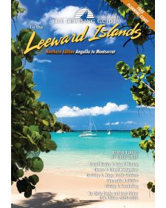
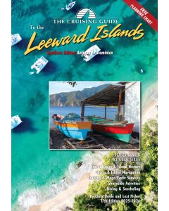
The Cruising Guide to the Northern Leeward Islands

- FREE Delivery to UK - Spend over £75
- FREE Delivery to Europe - Spend over £150
- Worldwide Delivery Available
Northern Edition - Anguilla to Montserrat. Includes Travel Basics & Island History, Charts & Island Navigation, Cruising & Mega Yacht Services, Shoreside Activities, Diving & Snorkling.
Product Details
Part Number: PIL0426
Edition: 2025-2026
Printed and corrected to: No
ISBN: 9798986585840
Publisher: Cruising Guide Publications
Language: English
Format: Spiralbound
This 17th edition (2025-2026) is split into two guides, The Cruising Guide to the Northern Leeward Islands and The Cruising Guide to the Southern Leeward Islands. The Cruising Guide to the Northern Leeward Islands picks up where The Cruising Guide to the Virgin Islands ends, covering the islands of Anguilla, St. Martin & Sint Maarten, St. Barts, Saba, Statia, St. Kitts, Nevis, Redonda, and Montserrat. If you are sailing south, there is a section that covers passages to the islands covered in The Cruising Guide to the Southern Leeward Islands.
These guides are an essential tool for all cruisers sailing this region. The authors spend months sailing these islands to update each edition. Included are over one hundred up-to-date color sketch charts, full color aerial photos of most anchorages, island pictures, and detailed shoreside information covering services, restaurants, provisioning, travel basics and island history. Information is linked to the authors’ website where you can download the GPS waypoints given in the sketch charts, learn of essential updates, print town maps, and obtain links to local weather, news, and businesses.
A free 17 x 27 inch waterproof planning chart of the northern and southern Leeward Islands is now included in each edition!
About the Author
Chris Doyle's cruising guides are among the most popular in the Eastern Caribbean. Chris attributes this to listening to his customers when they tell him what they would like to see in a guide, and following their ideas when it makes sense. In this way his guides have always been highly innovative, leading the way in color sketch charts, then computerized color sketch charts, GPS waypoints, star charts and a guide-linked website where people can find corrections, download town maps, download GPS waypoints, access navigational advisories, and get links to down island businesses.


![The 2024-2025 Sailors Guide to the Windward Islands [PRE-ORDER]](https://www.bookharbour.com/media/catalog/product/cache/f073062f50e48eb0f0998593e568d857/s/m/smallcover-wwi-24-25-45.png)