UK 5: NV.Atlas England - Thames Estuary to Great Yarmouth

- FREE Delivery to UK - Spend over £75
- FREE Delivery to Europe - Spend over £150
- Worldwide Delivery Available
Product Details
Part Number: YOT0006UK5
Scale: 1:1(Various)
ISBN: 9783945902202
Publisher: NV Charts
Edition: 2023
Printed and corrected to: edition date
Format: Combipack - Paper / Download and app
Language: English
MPN: 9783945902202
- Passage Charts
- Coastal Charts
- Details
- Tides and Currents
- nv charts app code
- notes in english
The product has been derived in part from UKHO (or any other custodian) data. They include numerous harbourplans and details for approaches, passages and anchorages of the given area, extra details for rivers and channels, as well as notes and warnings for the given waters. Visitor berths and moorings are shown highlighted in colour. The clear structure makes finding harbour details or anchorages a matter of seconds. In this way mariners get quick access to all important navigational information. All information is also shown in the nv charts App. Tide- and current data are available in tables and charts in paper.
The cartography captivates through ideal scales and wellchosen sheet cuts.
Scales
Passage Charts
C1 English Channel 1:1.750.000
C2 River Thames to Great Yarmouth 1: 375.000
Coastal Charts
C3 Harwich Approach · Sunk Centre 1: 150.000
C4 Great Yarmouth to Felixstowe 1: 150.000
C5 Thames Estuary North 1: 75.000
C6 Harwich Approaches 1: 75.000
C7 Orford to Southwold 1: 75.000
C8 Southwold to Great Yarmouth 1: 75.000
C9 River Crouch Approach 1: 30.000
C10 Rivers Crouch & Roach 1: 30.000
C11 River Colne 1: 30.000
C12 River Blackwater 1: 30.000
C16 Harwich Deep Water Channel 1: 30.000
C18 Rivers Orwell & Stour 1: 30.000
C19 River Deben 1: 30.000
C20 Rivers Ore & Alde 1: 30.000
C22A Great Yarmouth Approach 1: 30.000
C22B Lowestoft Approach 1: 30.000
Details
C13A Fambridge & Brandy Hole · R.Crouch 1: 12.000
C13B Burnham-on-Crouch · R.Crouch 1: 10.000
C13C Bridgemarsh Marina · R.Crouch 1: 10.000
C14 West Mersea Marinas · R.Blackwater 1: 12.000
C15A Brightlingsea · R.Colne 1: 8.000
C15B Maldon· R.Blackwater 1: 12.000
C15C Colchester · R.Colne 1: 15.000
C17 Walton Backwaters 1: 15.000
C19A Woodbridge · R.Deben 1: 12.000
C20A Southwold · R.Deben 1: 10.000
C21A Harwich 1: 10.000
C21B Suffolk Yachthbr. · R.Orwell 1: 10.000
C21B Woolverstone Marina · R.Orwell 1: 8.000
C21D Ipswich · R.Orwell 1: 12.000
C23A Lowestoft Harbour 1: 10.000
C23B Great Yarmouth Harbour 1: 10.000
Legend · General Notes C24
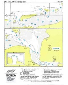
Tidal Stream Charts C25
Tide Tables · Tidal Stream Tables C26