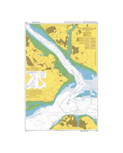
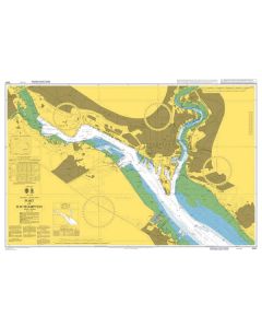
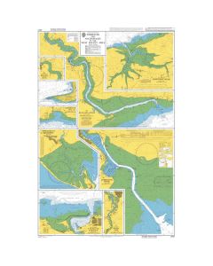
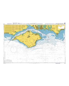
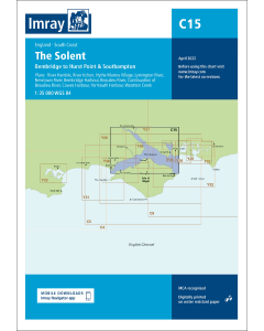
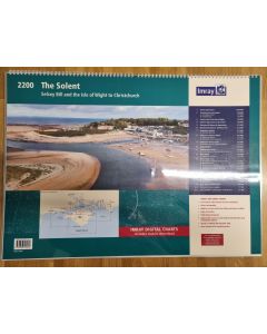
C15 The Solent (Imray Chart)

- FREE Delivery to UK - Spend over £75
- FREE Delivery to Europe - Spend over £150
- Worldwide Delivery Available
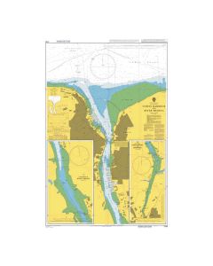
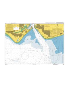
Bembridge to Hurst Point and Southampton
Product Details
Part Number: YOT0211
Scale: 1:35000
ISBN: 9781786795717
Publisher: Imray Laurie Norie And Wilson Ltd
Edition: 2024
Printed and corrected to: March 2024
Format: Sheet size 787 x 1118mm. Waterproof. Folded in plastic wallet.
Language: English
MPN: ICC15-7
Covering one of the most popular sailing areas in Britain, The Solent chart provides all the information needed for planning and navigating this stretch of water.
This edition includes the latest official data from the UKHO combined with additional information sourced from Imray's network to make it ideal for small craft.
New: Vessel Traffic Services (VTS) reporting points
Imray charts for the Solent and approaches now include all VTS reporting points found in these waters. VTS reporting is mandatory for vessels of more than 20m in length that are bound to and from the Solent.
The latest racing buoy information is included and the chart has been fully revised throughout.
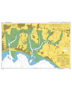
Plans included: River Hamble (1:12 500)
River Itchen (1:12 500)
Hythe Marina Village (1:12 500)
Lymington River (1:15 000)
Newtown River (1:20 000)
Bembridge Harbour (1:10 000)
Beaulieu River (1:20 000)
Continuation of Beaulieu River (1:20 000)
Cowes Harbour (1:20 000)
Yarmouth Harbour (1:4500)
Wootton Creek (1:20 000)


![Eyeball Chart Plotter [Laminated] - The Solent](https://www.bookharbour.com/media/catalog/product/cache/f073062f50e48eb0f0998593e568d857/y/o/yot7065.jpg)


![NP255 - ADMIRALTY Tidal Stream Atlas: Falmouth to Padstow [including Isles of Scilly]](https://www.bookharbour.com/media/catalog/product/cache/f073062f50e48eb0f0998593e568d857/n/p/np255_1.jpg)


![Channel Havens: Secret Inlets & Secluded Anchorages of the Channel [BACKORDER]](https://www.bookharbour.com/media/catalog/product/cache/f073062f50e48eb0f0998593e568d857/p/i/pil0580.jpg)