C36 Ile d'Ouessant to Raz de Sein (Imray Chart)

- FREE Delivery to UK - Spend over £75
- FREE Delivery to Europe - Spend over £150
- Worldwide Delivery Available
Imray Chart
Product Details
Part Number: YOT0430
Scale: 1:80000
ISBN: 9781786791313
Publisher: Imray Laurie Norie And Wilson Ltd
Edition: 2019
Printed and corrected to: February 2024
Format: Sheet size 787 x 1118mm. Waterproof. Folded in plastic wallet.
Language: English
MPN: ICC36-3
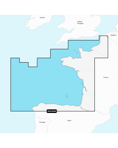
The west coast of North Brittany from Ouessant down to the Raz de Sein. Scale 1:77,300. One-minute gridlines. Larger scale plans of Le Conquet, Port de Brest, Morgat, Camaret-sur-mer, Douarnenez, Baie de lampaul(Ouessant), Marina du Moulin Blanc, Brest. Tidal stream diagrams.
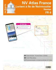
South Brittany Nautical Charts

Atlantic France Imray Charts

Brittany & Channel Islands Cruising Guides & Pilot Books


Atlantic Europe Cruising Guides & Pilot Books


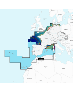
Atlantic Europe Regular Digital Charts


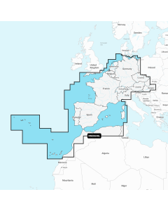
Atlantic Europe Large Digital Charts
-
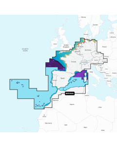
Navionics+ Large - Europe, Central & West
Special Price £220.00 Regular Price £229.99Stock In stock -
-
-