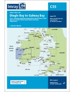
C55 Dingle Bay to Galway Bay (Imray Chart)

- FREE Delivery to UK - Spend over £75
- FREE Delivery to Europe - Spend over £150
- Worldwide Delivery Available
UK Imray Chart
Product Details
Part Number: YOT0638
Scale: 1:200000
ISBN: 9781846236853
Publisher: Imray Laurie Norie And Wilson Ltd
Edition: 2015
Printed and corrected to: February 2024
Format: Sheet size 787 x 1118mm. Waterproof. Folded in plastic wallet.
Language: English
MPN: 9781846236853
Plans included:
Cashla Bay (1:30 000)
Galway Bay (1:40 000)
Galway Harbour (1:15 000)
Kilronan (Aran Is.) (1:45 000)
River Shannon to Limerick (1:110 000)
Kilrush (1:30 000)
Foynes Harbour (1:17 500)
Fenit Island (1:35 000)
Dingle Harbour (1:25 000)
On this 2015 edition revised depths are shown throughout, in particular at Cashla Bay, Galway Bay, Kilronan, around Fenit Island and at Dingle Bay. Completed harbour developments at Kilronan are also shown.

![NP255 - ADMIRALTY Tidal Stream Atlas: Falmouth to Padstow [including Isles of Scilly]](https://www.bookharbour.com/media/catalog/product/cache/f073062f50e48eb0f0998593e568d857/n/p/np255_1.jpg)