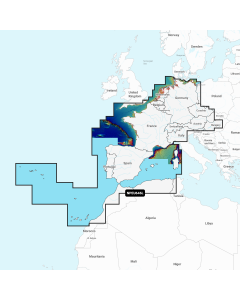
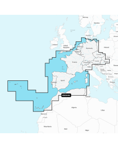
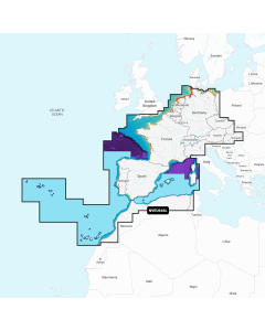
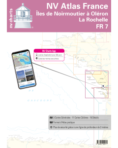
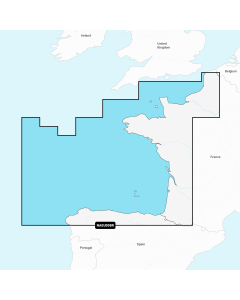
FR 7: NV.Atlas France - Iles de Noirmoutier à Oléron (La Rochelle)

- FREE Delivery to UK - Spend over £75
- FREE Delivery to Europe - Spend over £150
- Worldwide Delivery Available
This atlas contains a download code for all charts in this area to be used with the nv chart app. The app is compatible with Apple: iOS/MacOSX, Android & Windows: 7/8/10.
Product Details
Part Number: YOT0006FR7
Scale: 1:1(Various)
ISBN: 9783945902271
Publisher: NV Charts
Edition: 2023
Printed and corrected to: edition date
Format: Combipack - Paper / Download and app
Language: English, French
MPN: 9947
NV charts for the French Atlantic coast are based on official data of the French Hydrographic Office SHOM. They include numerous details for harbours and approaches, passages and anchorages of the given area, extra details for rivers and channels, as well as bridge clearances, opening times, notes and warnings for the given waters. Buoys and marks are shown according to the international IHO regulations. The clear structure makes finding harbour details or anchorages a matter of seconds. In this way the mariner gets quick access to all important navigational information. All information is also shown in the nv charts App. The cartography captivates through ideal scales and well-chosen sheet cuts.
Passage Charts - Cartes Hauturières
C 1 France · Atlantique 1: 1.750.000 C 2 Belle-Ile à La Rochelle 1: 350.000
C 3 La Rochelle à Arcachon 1: 350.000
Coastal Charts - Cartes Côtières
C 4 Le Pouliguen à l‘Ile de Noirmoutier 1: 150.000
C 5 Ile de Noirmoutier aux Sables d‘Olonne 1: 150.000
C 6 Les Sables d‘Olonne à La Rochelle 1: 150.000
C 7 Ile de Noirmoutier · Nord 1: 45.000
C 8 Ile d‘Yeu 1: 45.000
C 9 St.Gilles aux Sables d‘Olonne 1: 45.000
C10 Les Sables à Jard-sur-Mer 1: 45.000
C11 Ile de Ré · Nord 1: 45.000
C12 Approches de la Rochelle 1: 45.000
C13 La Rochelle · Île D’Oléron 1: 45.000
C14 Île D’Oléron · Charente 1: 45.000
Details
C15 La Charente 1: 25.000
C15A Rochefort 1: 10.000
C16 La Rochelle 1: 15.000
C17A Les Sables-d‘Olonne 1: 15.000
C17B L‘Herbaudière 1: 10.000
C17C St.Martin-de-Ré 1: 10.000
C17D Noirmontier-en-l‘lle 1: 15.000
C17E St.-Gilles-Croix-de-Vie 1: 15.000
C17F Goulet de Fromentine 1: 45.000
C18A Port Joinville 1: 10.000
C18B Jar-sur-Mer 1: 10.000
C18C Bourgenay 1: 10.000
C18D St.-Denis-d‘Oléron 1: 10.000
C18E Boyardville 1: 10.000
C19A Ars-en Ré 1: 15.000
C19B Port Douhet 1: 10.000
Distances C19
Légende · Legend 20
Courants de Marée · Tidal Stream Tables 20
Atlantic France Imray Charts


Atlantic Europe Cruising Guides & Pilot Books

Atlantic Europe Regular Digital Charts


Atlantic Europe Large Digital Charts
-
Navionics+ Large - Europe, Central & West
Special Price £220.00 Regular Price £229.99Stock In stock -
-
-