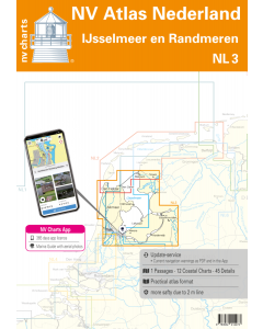
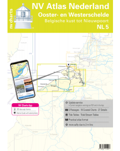
NL3: NV Atlas Nederland - Ijsselmeer en Randmeren

- FREE Delivery to UK - Spend over £75
- FREE Delivery to Europe - Spend over £150
- Worldwide Delivery Available
This atlas contains a download code for all charts in this area to be used with the nv chart app. The app is compatible with Apple: iOS/MacOSX, Android & Windows: 7/8/10.
Product Details
Part Number: YOT0006NL3
Scale: 1:1(Various)
ISBN: 9783910644267
Publisher: NV Charts
Edition: 2025
Printed and corrected to: edition date
Format: Combipack - Paper / Download and app
Language: Dutch, German
MPN: 9863
For a trip through the popular sailing area of the IJsselmeer there is no getting around the NL3. Once you have passed one of the lock gates nothing stands in the way of an eventful cruise. The IJsselmeer does not have strong tides like other Dutch areas (for example the Waddenzee) but you still have to reckon with strong winds. You should also watch out for the numerous fishing nets in the IJsselmeer.
The region is characterised by charming little fishing villages coastal towns and old cities rich in history long sandy beaches and many sheep on the green dikes. There is also no shortage of harbours in the IJsselmeer with some towns offering several places to moor. Especially the larger ports of Lemmer Lelystad Enkhuizen Hindeloopen and the northern part of Amsterdam offer many opportunities for stopovers. A trip to the capital city with its numerous canals and canals is highly recommended!
The clear layout of the nautical chart enables the yachtsman to find approaches harbours and anchorages quickly and is pointed out to navigationally important details that also appear in the nv charts app. The tide data and current information are also available for the navigation programme and app. The chart series impresses with its detailed scales and optimal sheet cuts.
This chart set contains
- 1 oversailer
- 11 precinct charts
- 42 detailed charts
- Code for App
- Digital charts & navigation program 365 days licence
- Current data in the digital charts
- Tidal calendar
- Paper harbour plans & Digital
- Meets legal requirements for up-to-date paper charts on board
Update - Update
The chart sets for the Netherlands are published annually in updated editions. For the digital nautical charts updates are made available as downloads at the beginning of the season. Up-to-date nautical charts are the basis of safe navigation. NV Charts offers a monthly updating service for its North Sea charts from April to October. So that your charts are always up to date.
NV Atlas chart format
NV Charts nautical charts are available in an outstandingly practical, handy atlas booklet format and thus offer many advantages over formats from other manufacturers. The nautical chart series have been designed by nautical experts and passionate water sports enthusiasts with the needs of recreational boating in mind.
The NV Atlas has a very flat staple binding in the middle, so that the course triangle can also be used there without any problems. This innovative development makes it possible to look up charts quickly and always have them in the best possible order at the same scale. The NV Atlas is delivered in a plastic cover protected against splash water. This modern nautical chart format is very popular on sailing boats as well as on motor yachts and is the preferred choice of many of our customers.
NV Charts navigation app
All NV Charts nautical charts also include an access code to the digital nautical charts in the NV Charts app and can thus be easily downloaded and used for offline navigation with the NV Charts app on iOS, Android, PC and Mac or also in the web browser.
The NV Charts app is the ideal addition on mobile devices. With the app, you can already plan a detailed route at home and thus prepare for your journey in the best possible way in conjunction with the paper chart. The app is intuitive to use and, thanks to an identical map image, you can orientate yourself on paper and digitally in a matter of seconds. The most up-to-date information is essential to navigate safely on the water with your sailboat or motorboat.
With the NV Charts app, you now have the opportunity to become part of the chart community. You can mark harbours, anchorages and navigation warnings on the digital nautical chart and also add interesting places beyond navigation, such as restaurants, with pictures and comments and share your experiences with other users. In addition, the NV Charts app offers an automatic routing function, search and all navigation functions for GPS navigation with your phone or tablet. More information at: nvcharts.com/app
More PC navigation apps: NV Verlag / NV Charts nautical charts can also be used in many other nv.digital compatible PC navigation programs such as NV Chart Navigator or Open CPN.
Our recommendation
For the further journey south the NL4 is a good choice the transition between the two charts is in Amsterdam. In the north you can use the NL2 in the direction of the Waddenzee. For a further trip to the northern inland of the Netherlands the NL6 is best suited for the southern inland the NL7. As a cruising guide we recommend the work "Nautical Travel Tips IJsselmeer" by Ertay Hayit.
Containing charts and scales
Oversailers
C1 Rotterdam tot IJsselmeer 1:375.000
District Maps
C2 IJsselmeer Noord 1:80.000 C3 IJsselmeer Zuid 1:80.000 C4 Markermeer 1:80.000 C8A Gouwzee 1:30.000 C10 Friese Meren Oost 1:50.000 C11 Friese Meren West 1:50.000 C14 Randmeren- Gooimeer- Eemmeer 1:50.000 C15 Randmeren - Wolderwijd 1:50.000 C16 Randmeren - Veluwemeer 1:50.000 C17 Randmeren - Elburg - Ketelbrug 1:50.000 C18 Overijssel - Zwarte Meer - Zwolle 1:50.000
Details
C5A Kornwerderzand - Makkum 1:20.000 C5B Den Oever 1:20.000 C5C Stavoren 1:20.000 C6A Enkhuizen 1:15.000 C6B Breezanddijk 1:15.000 C6C Medemblik 1:15.000 C6D Hindeloopen 1:20.000 C7A Lemmer 1:15.000 C7B Lelystad 1:20.000 C8B Edam 1:5.000 C8C Haven Volendam 1:5.000 C8D Marina Volendam 1:5.000 C8E Andijk 1:10.000 C8F Uitdam 1:5.000 C8G Marken 1:5.000 C9A Hollandse Brug 1:5.000 C9B Durgerdam 1:5.000 C9C Hoorn 1:10.000 C9D Monnickendam 1:5.000 C11A Sneekermeer - Sneek 1:30.000 C11B Heeg 1:30.000 C11C Langweer 1:30.000 C12 Amsterdam Havens West 1:20.000 C13 Amsterdam Havens Oost 1:20.000 C15A Harderwijk 1:15.000 C17A Ketelmeer 1:30.000 C19A Roggebotsluis 1:15.000 C19B Eemmond 1:15.000 C19C Zwartsluis 1:15.000 C19D Bremerbergse Hoek 1:15.000 C19E Nijkerk 1:15.000 C19F Hasselt 1:15.000 C19G Zeewolde 1:15.000 C19H Huizen 1:15.000 C19J Spakenburg 1:15.000 C20A Urk 1:10.000 C20B Kampen 1:15.000 C20C Elburg 1:15.000 C20D Almere Haven 1:15.000 C20E Nulde 1:10.000 C20F Genemuiden 1:10.000 C20G Muiden 1:10.000
![1820 IJsselmeer, Markermeer, Noordzeekanaal en Ijsseldelta [PRE-ORDER]](https://www.bookharbour.com/media/catalog/product/cache/f073062f50e48eb0f0998593e568d857/n/l/nl1820.jpeg)