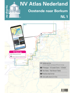
NL1: NV Atlas Nederland - Oostende naar Borkum

- FREE Delivery to UK - Spend over £75
- FREE Delivery to Europe - Spend over £150
- Worldwide Delivery Available
This atlas contains a download code for all charts in this area to be used with the nv chart app. The app is compatible with Apple: iOS/MacOSX, Android & Windows: 7/8/10.
Product Details
Part Number: YOT0006NL1
Scale: 1:1(Various)
ISBN: 9783932414459
Publisher: NV Charts
Edition: 2024
Printed and corrected to: edition date
Format: Combipack - Paper / Download and app
Language: Dutch, German
MPN: 9861
The Dutch nautical charts from NV start with the NL1. This chart set follows on from the southernmost German North Sea chart DE13 and is the optimal connecting chart to reach the UK by a direct route or to cross the English Channel on the French side. Wind farms oil platforms and traffic separation areas are clearly marked on this chart set. Important harbour approaches such as Borkum Terschelling Vlissingen Ijmuiden/Amsterdam Oostende etc. are also listed so that in case of bad weather there is the possibility of mooring again and possibly seeking shelter. Otherwise the NL1 is a chart set that is ideally suited for crossings and quick transits.
The clearly laid out nautical chart allows the recreational skipper to find approaches harbours and anchorages quickly and is pointed out to navigationally important details that also appear in the nv charts app. The tide data and current information are also available for the navigation programme and app. The chart series impresses with its detailed scales and optimal sheet cuts.
This chart set contains:
- 4 oversailers
- 13 precinct charts
- 13 detailed charts
- Code for the nv charts app
- Digital charts & navigation program 365 days licence
- Current data in the digital charts
- Tidal calendar
- Harbour plans paper & Digital
- Navigation information in German and Dutch
Update - Update
The chart sets for the Netherlands are published annually in updated editions. For the digital nautical charts updates are made available as downloads at the beginning of the season. Up-to-date nautical charts are the basis of safe navigation. NV Charts offers a monthly updating service for its North Sea charts from April to October. This ensures that your charts are always up to date.
NV Atlas chart format
NV Charts nautical charts are available in an outstandingly practical, handy atlas booklet format and thus offer many advantages over formats from other manufacturers. The nautical chart series have been designed by nautical experts and passionate water sports enthusiasts with the needs of recreational boating in mind.
The NV Atlas has a very flat staple binding in the middle, so that the course triangle can also be used there without any problems. This innovative development makes it possible to look up charts quickly and always have them in the best possible order at the same scale. The NV Atlas is delivered in a plastic cover protected against splash water. This modern nautical chart format is very popular on sailing boats as well as on motor yachts and is the preferred choice of many of our customers.
NV Charts navigation app
All NV Charts nautical charts also include an access code to the digital nautical charts in the NV Charts app and can thus be easily downloaded and used for offline navigation with the NV Charts app on iOS, Android, PC and Mac or also in the web browser.
The NV Charts app is the ideal addition on mobile devices. With the app, you can already plan a detailed route at home and thus prepare for your journey in the best possible way in conjunction with the paper chart. The app is intuitive to use and, thanks to an identical map image, you can orientate yourself on paper and digitally in a matter of seconds. The most up-to-date information is essential to navigate safely on the water with your sailboat or motorboat.
With the NV Charts app, you now have the opportunity to become part of the chart community. You can mark harbours, anchorages and navigation warnings on the digital nautical chart and also add interesting places beyond navigation, such as restaurants, with pictures and comments and share your experiences with other users. In addition, the NV Charts app offers an automatic routing function, search and all navigation functions for GPS navigation with your phone or tablet. More information at: nvcharts.com/app
More PC navigation apps: NV Verlag / NV Charts nautical charts can also be used in many other nv.digital compatible PC navigation programs such as NV Chart Navigator or Open CPN.
Our recommendation
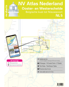
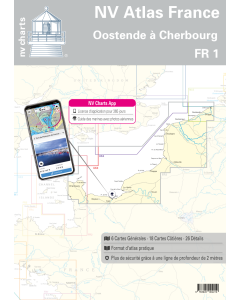
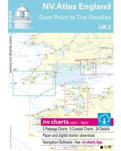
We recommend NL2 as a further chart set to get to know the offshore Wadden Islands or UK5 and UK4 to travel directly to the UK. FR1 is a good choice if you want to continue through the English Channel on the Normandy side. A connection to the NL3 for the Ijsselmer the NL4 for the Rijn & Maas Delta and the NL5 for Ooster- & Westerschelde is also given.
Containing maps and scales
Oversailer
C1 Oostende tot IJmuiden 1:375.000 C2 IJmuiden tot Den Helder 1:375.000 C3 Den Helder tot Borkum 1:375.000
Area Maps
C4 Oostende tot Westkapelle 1:100.000 C5 Westkapelle tot Westhoofd 1:100.000 C6 Westhoofd tot Europoort 1:100.000 C7 Europoort tot Noordwijk aan Zee 1:100.000 C8 Noordwijk aan Zee tot IJmuiden 1:100.000 C9 IJmuiden tot Kijkduin 1:100.000 C10 Kijkduin tot Vlieland 1:100.000 C11 Vlieland tot Terschelling 1:100.000 C12 Terschelling tot Het Rif 1:100.000 C13 Het Rif tot Borkum 1:100.000 C15 Noordzeekanaal - IJmuiden tot Amsterdam 1:50.000
Details
C14A Oostende 1:15.000 C14B Scheveningen 1:15:000 C14C Roompotsluis 1:20.000 C14D Zeebrugge 1:25:000 C14E Blankenberge 1:10.000 C14F Zeebrugge - Prins Albertdok 1:10.000 C16A IJmuiden 1:20.000 C16B Vlissingen 1:25.000 C17A Borkum Haven 1:15.000 C17B Den Helder 1:15.000 C17C West-Terschelling 1:10.000 C17D Aanloop West-Terschelling 1:30.000
![1820 IJsselmeer, Markermeer, Noordzeekanaal en Ijsseldelta [PRE-ORDER]](https://www.bookharbour.com/media/catalog/product/cache/f073062f50e48eb0f0998593e568d857/n/l/nl1820.jpeg)