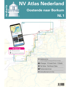
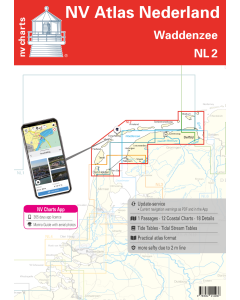
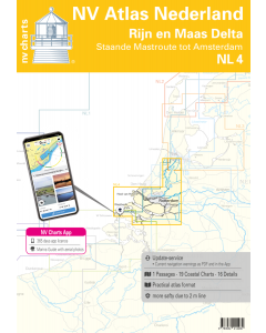
NL4: NV.Atlas Nederland - Rijn en Maas Delta

- FREE Delivery to UK - Spend over £75
- FREE Delivery to Europe - Spend over £150
- Worldwide Delivery Available
This atlas contains a download code for all charts in this area to be used with the nv chart app. The app is compatible with Apple: iOS/MacOSX, Android & Windows: 7/8/10.
Product Details
Part Number: YOT0006NL4
Scale: 1:1(Various)
ISBN: 9783932414480
Publisher: NV Charts
Edition: 2024
Printed and corrected to: edition date
Format: Combipack - Paper / Download and app
Language: Dutch, German
MPN: 9864
For the water sports area around Rotterdam the southern part of the famous "Staande Mastroute" and the Maas Delta the NL4 is the perfect companion. In the north the Atlas starts at the capital Amsterdam which is definitely worth a detour. The small canals and canals are a very charming water sports area. The famous port city of Rotterdam is also a thoroughly impressive area. As the largest port in Europe it is naturally very busy which is why you should definitely watch out for large ships and containers on the citys canals and also on the way there. The Maas Delta south of Rotterdam is much quieter. The branching rivers and tributaries are partly shallow and the strong tides should also be carefully observed. The area has numerous smaller nature reserves. This makes for a comparatively calmer atmosphere but should also be taken into account when planning the voyage as sailing in these areas is only permitted to a limited extent or is even prohibited altogether.
The clear layout of the nautical chart means that the recreational skipper can quickly find approaches harbours and anchorages and is made aware of navigationally important details that also appear in the nv charts app. The tide data and current information are also available for the navigation programme and app. The chart series impresses with its detailed scales and optimal sheet cuts.
This chart set contains
- 1 oversailer
- 17 precinct charts
- 17 detailed charts
- Code for the nv charts App
- Digital charts & navigation program 365 days licence
- Current data in the digital charts
- Tidal calendar
- Paper harbour plans & Digital
Update - Update
The chart sets for the Netherlands are published annually in updated editions. For the digital nautical charts updates are made available as downloads at the beginning of the season. Up-to-date nautical charts are the basis of safe navigation. NV Charts offers a monthly updating service for its North Sea charts from April to October. This ensures that your charts are always up to date.
NV Atlas chart format
NV Charts nautical charts are available in an outstandingly practical, handy atlas booklet format and thus offer many advantages over formats from other manufacturers. The nautical chart series have been designed by nautical experts and passionate water sports enthusiasts with the needs of recreational boating in mind.
The NV Atlas has a very flat staple binding in the middle, so that the course triangle can also be used there without any problems. This innovative development makes it possible to look up charts quickly and always have them in the best possible order at the same scale. The NV Atlas is delivered in a plastic cover protected against splash water. This modern nautical chart format is very popular on sailing boats as well as on motor yachts and is the preferred choice of many of our customers.
NV Charts navigation app
All NV Charts nautical charts also include an access code to the digital nautical charts in the NV Charts app and can thus be easily downloaded and used for offline navigation with the NV Charts app on iOS, Android, PC and Mac or also in the web browser.
The NV Charts app is the ideal addition on mobile devices. With the app, you can already plan a detailed route at home and thus prepare for your journey in the best possible way in conjunction with the paper chart. The app is intuitive to use and, thanks to an identical map image, you can orientate yourself on paper and digitally in a matter of seconds. The most up-to-date information is essential to navigate safely on the water with your sailboat or motorboat.
With the NV Charts app, you now have the opportunity to become part of the chart community. You can mark harbours, anchorages and navigation warnings on the digital nautical chart and also add interesting places beyond navigation, such as restaurants, with pictures and comments and share your experiences with other users. In addition, the NV Charts app offers an automatic routing function, search and all navigation functions for GPS navigation with your phone or tablet. More information at: nvcharts.com/app
More PC navigation apps: NV Verlag / NV Charts nautical charts can also be used in many other nv.digital compatible PC navigation programs such as NV Chart Navigator or Open CPN.
Our recommendation
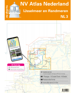
For a continuation of your journey into the popular IJsselmeer the NL3 is recommended to the north. If you want to continue in the other direction we recommend NL5 to the southern part of the Netherlands and for Belgium. For the southern inland part of the Netherlands NL7 is again the perfect travel companion.
Containing maps and scales
Oversailers
C1 Zuidelijke Noordzeekust - Zeeland 1:375.000
Area maps
C2 West Schouwen tot Westhoofd 1:50.000 C3 Westhoofd tot Europoort 1:50.000 C4 Europoort - Maasgeul 1:30.000 C5 Nieuwe Waterweg - Maassluis 1:25.000 C6 Rotterdam West 1:25.000 C7 Rotterdam Oost 1:25.000 C8 Zwijndrecht - Dordrecht 1:20.000 C9 Brielsemeer West 1:15.000 C10 Brielsemeer Oost en Hartelkanaal 1:15.000 C11A-B Heerjansdam tot Zuidland 1:20.000 C12 Haringvliet West 1:30.000 C13 Haringvliet Oost en Volkerak Noord 1:30.000 C14A-B Hollandsch Diep 1:30.000 C15 Grevelingen Meer West 1:30.000 C16 Grevelingen- en Kramersluizen 1:50.000 C19 Staande Mastroute - Rotterdam tot Alphen 1:50.000 C20 Staande Mastroute - Alphen tot Amsterdam 1:50.000
Details
C10A Rotterdam 1:15.000 C17A Strijensas 1:7.500 C17B Noordschans 1:10.000 C17C Dintelas 1:15.000 C17D Willemstad 1:10.000 C17E Benedensas 1:15.000 C17F Hellevoetsluis 1:10.000 C17G Oude Tonge 1:10.000 C17H Middelharnis 1:7.500 C17J Ooltgensplaat 1:7.5000 C18A Ouddorp 1:10.000 C18B Herkingen 1:10.000 C18C Scharendijke 1:10.000 C18D Marina Port Zélande 1:10.000 C18E Bruinisse 1:15.000 C18F Brouwershaven 1:10.000 C20A Staande Mastroute - Amsterdam 1:20.000
![1820 IJsselmeer, Markermeer, Noordzeekanaal en Ijsseldelta [PRE-ORDER]](https://www.bookharbour.com/media/catalog/product/cache/f073062f50e48eb0f0998593e568d857/n/l/nl1820.jpeg)