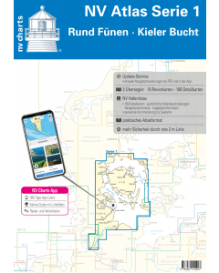
NV.Atlas Serie 1: Rund Fünen & Kieler Bucht

- FREE Delivery to UK - Spend over £75
- FREE Delivery to Europe - Spend over £150
- Worldwide Delivery Available
This atlas contains a download code for all charts in this area to be used with the nv chart app. The app is compatible with Apple: iOS/MacOSX, Android & Windows: 7/8/10.
Product Details
Part Number: YOT0006DE1
Scale: 1:1(Various)
ISBN: 9783910644007
Publisher: NV Charts
Edition: 2025
Printed and corrected to: edition date
Format: Combipack - Paper / Download and app
Language: English, German
MPN: 1701
The NV Atlas Series 1 accompanies you from the Bay of Kiel via the Eckernförde Bay directly into the Schlei with its beautiful little harbors and protected anchorages as far as the Danish South Seas and around Fyn. For many, the Schlei and the Kiel Fjord are a starting point for a relaxing day trip to the Danish South Seas with its small islands and dreamy harbours. The Flensburg Fjord with the ox islands and Alssund are among the destinations that round off this breathtaking landscape. Many water sports enthusiasts are drawn to the harbours and anchor bays around Funen not only for the summer cruise.
The handy sports boat charts are a set of charts specially designed for recreational boating. Charts for the sea area around Funen & Bay of Kiel include the nautical charts in various scales as well as all harbour plans and details for approaches and passages in the waters. In addition clearance heights for bridges power lines etc. as well as all nautical and navigational details are included. Thanks to the clear structure the recreational skipper can quickly find approaches harbours and anchorages and is pointed to navigationally important details that also appear in the NV Charts app. The chart series impresses with its detailed scales and optimal sheet sections.
The chart set includes
- 3 Passage Charts
- 18 Coastal Charts
- 9 detailed charts
- including Schlei to Schleswig and Kiel Canal
- nv charts app and navigation software 365 days licence
- new: Vector charts download
- Harbour pilot in paper / digital in German and English
- Navigation instructions in German
- Meets legal requirement for up-to-date paper charts on board of Pleasure craft
Scales
Overview charts
Übersichtskarte Serie 1 1:750.000S 1 Kieler Bucht West 1:150.000
S 1A Kiel Bight East 1:150.000
Coastal charts
S 2 Kiel Fjord 1 : 40.000 S 3 Kiel Bight South-West 1 : 80.000 S 4 Flensburg Fjord 1 : 80.000 S 5 Little Belt South 1 : 80.000 S 6 Little Belt Centre 1 : 80.000 S 7 Small Belt North 1 : 80.000 S 8 North Funen West 1 : 80.000 S 8A North Funen East 1 : 80.000 S 9 Great Belt North 1 : 80.000 S 10 Great Belt Centre 1 : 80.000 S 11 Great Belt South 1 : 80.000 S 12 South Funen 1 : 80.000 Schlei 1 + 2 1 : 35.000 NOK Kiel Canal 1 + 2 (4 maps) 1 : 55.000Details
S 4A Inner Flensburg Fjord 1 : 35.000 S 6A Alssund & Augustenborgfjord 1 : 25.000 S 7A Snævringen & Kolding Fjord 1 : 40.000 S 8B Odense & Haderslev Fjord 1 : 35.000 1 : 42.000 S 10A Approaches Great Belt Bridge 1 : 30.000 S 12A Svendborg Sund 1 : 18.000 S 12B Approaches Fåborg / Rudkøbing Løb & Marstal 1 : 33.000 S 12C Nakskov Fjord & Inner Eckernförde Bay 1 : 30.000Baltic Sea NV.Atlases
-
-
-
-
-
-
-
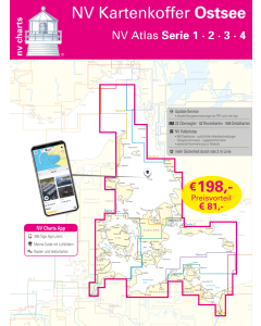
NV.Kartenkoffer Ostsee - NV.Atlas Serie 1, 2, 3 & 4
Special Price £249.00 Regular Price £339.96Stock In stock -
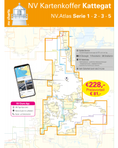
NV.Kartenkoffer Kattegat - NV.Atlas Serie 1, 2, 3, 5.1& 5.2
Special Price £269.00 Regular Price £404.95Stock In stock -
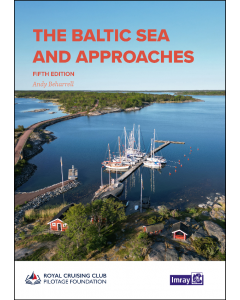
Baltic Sea Cruising Guides & Pilot Books


Baltic Sea Germany & Denmark NV.Atlases
-
-
-
-
NV.Kartenkoffer Ostsee - NV.Atlas Serie 1, 2, 3 & 4
Special Price £249.00 Regular Price £339.96Stock In stock -
NV.Kartenkoffer Kattegat - NV.Atlas Serie 1, 2, 3, 5.1& 5.2
Special Price £269.00 Regular Price £404.95Stock In stock -