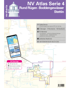
NV.Atlas Serie 4: Rund Rügen, Boddengewässer & Stettin

- FREE Delivery to UK - Spend over £75
- FREE Delivery to Europe - Spend over £150
- Worldwide Delivery Available
This atlas contains a download code for all charts in this area to be used with the nv chart app. The app is compatible with Apple: iOS/MacOSX, Android & Windows: 7/8/10.
Product Details
Part Number: YOT0006DE4
Scale: 1:1(Various)
ISBN: 9783910644038
Publisher: NV Charts
Edition: 2025
Printed and corrected to: edition date
Format: Combipack - Paper / Download and app
Language: English, German
MPN: 1704
For all water sports enthusiasts who want to get to know the scenically unique Bodden waters around Darß Rügen and Usedom or want to start from Rügen Series 4 is the map set that must not be missed. In addition to the Stettiner Haff this series also includes Bornholm. This combipack consists of 4 oversailers 13 district charts 8 detailed charts and a harbour pilot. The detailed paper charts as well as the possibility of digital use round off the package.
NV Charts for the Baltic Sea - The handy recreational boat charts are a chart series specially designed for recreational boating. Charts for the sea area around Rügen - Bodden waters - Szczecin include nautical charts in various scales as well as all harbour plans and details for approaches and passages in the waters. In addition clearance heights for bridges power lines etc. as well as all nautical and navigational details are included. Thanks to the clear structure the recreational skipper can quickly find accesses harbours and anchorages and is pointed to navigationally important details that also appear in the nv charts app. The chart series impresses with its optimal scales and balanced page cuts.
The chart set includes
- 4 Passage Charts
- 13 Coastal Charts
- 8 detail charts
- port pilot with plans for all marinas and pleasure craft harbours
- digital charts included
- new: Vector charts download
- nv charts app and navigation software 365 days licence
- Hafenlotse in paper / digital in German
- Navigation instructions in German
- Meets legal requirements for up-to-date paper charts on board
Passage Charts
Overview Map Series 4 1:370000 S 25 Bornholm 1:140000 S 45 Hiddensee to Swinemünde 1:250000 S 46 Rügen to Bornholm 1:230.000
Coastal Charts
S 36 The Bodden south of Zingst 1:60.000 S 37 Strelasund North 1:60.000 S 38 Hiddensee to Jasmund 1:60.000 S 39 Strelasund South 1:40.000 S 39A Stralsund 1:40.000 S 40 Greifswalder Bodden West 1:60.000 S 41 Greifswalder Bodden East 1:60.000 S 42 Peenestrom Süd 1:60.000 S 43 Stettiner Haff 1:80.000 S 43A Dievenow 1:60.000 S 44 Die Oder bis Stettin-Nord 1:30.000 S 44A Die Oder bis Stettin-Süd 1:30.000 S 45A Arkona bis Landtief 1:100.000
Detail
S 25 Christiansø 1:12.000 S 36 Am Bock 1:25.000 S 39A Vitter Bodden 1:30.000 S 39A Häfen Stralsund 1:12.000 S 41A Ruden bis Wolgast 1:40.000 S 42 Zecherin 1:40.000 S 43A Dievenow Ansteuerung 1:10.000 S 43A Swinemünde 1:40.000
Baltic Sea NV.Atlases
-
-
-
-
-
-
-
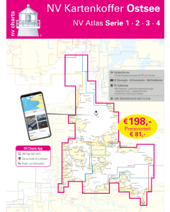
NV.Kartenkoffer Ostsee - NV.Atlas Serie 1, 2, 3 & 4
Special Price £249.00 Regular Price £339.96Stock In stock -
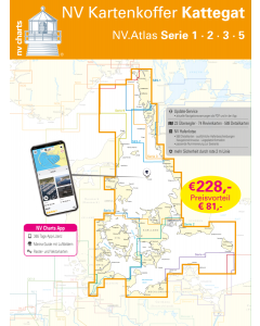
NV.Kartenkoffer Kattegat - NV.Atlas Serie 1, 2, 3, 5.1& 5.2
Special Price £269.00 Regular Price £404.95Stock In stock -
Baltic Sea Cruising Guides & Pilot Books


Baltic Sea Germany & Denmark NV.Atlases
-
-
-
-
NV.Kartenkoffer Ostsee - NV.Atlas Serie 1, 2, 3 & 4
Special Price £249.00 Regular Price £339.96Stock In stock -
NV.Kartenkoffer Kattegat - NV.Atlas Serie 1, 2, 3, 5.1& 5.2
Special Price £269.00 Regular Price £404.95Stock In stock -