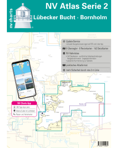
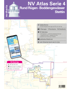
NV.Atlas Serie 2: Lübeck Bight, Bornholm & Copenhagen

- FREE Delivery to UK - Spend over £75
- FREE Delivery to Europe - Spend over £150
- Worldwide Delivery Available
This atlas contains a download code for all charts in this area to be used with the nv chart app. The app is compatible with Apple: iOS/MacOSX, Android & Windows: 7/8/10.
Product Details
Part Number: YOT0006DE2
Scale: 1:1(Various)
ISBN: 9783932414930
Publisher: NV Charts
Edition: 2024
Printed and corrected to: edition date
Format: Combipack - Paper / Download and app
Language: English, German
MPN: 1702
The NV Atlas Series 2 accompanies you from the Bay of Lübeck along the Mecklenburg coast, cutting into Rügen, to Bornholm. From there it goes via southern Sweden to Malmö and Copenhagen southeast via Moen, Falster and Lolland to Fehmarn back to the starting point. Wonderful trips are guaranteed with this chart series. Series 2 is suitable for those water sports enthusiasts who feel at home on the Baltic Sea and who want to get to know our delightful Baltic Sea with trips to Denmark and Sweden.
The handy recreational boat charts are a set of charts specially designed for recreational boating. Charts for the Lübeck Bay - Bornholm sea area include nautical charts in various scales as well as all port plans and details for approaches and passages in the waters. In addition clearance heights for bridges power lines etc. as well as all nautical and navigational information are included. Thanks to the clear structure the skipper can quickly find accesses harbours and anchorages and is pointed to navigationally important details that also appear in the nv charts app. The chart series impresses with its optimal scales and balanced page cuts.
This chart set includes
- 9 Passage Charts
- 8 Coastal Charts
- 15 detail charts
- Code for nv charts App 365 days licence
- new: Vector charts download
- nv charts app and navigation software
- Harbour Pilot in paper/digital in German and English
- Navigation instructions in German
-
Meets legal requirements for up-to-date paper charts on board
Scales
Overview charts
Overview chart series 2 1:520.000 S 15 Mecklenburg Bay West 1:155.000 S 15A Mecklenburg Bay East 1:155.000 S 16 Møn Southeast 1:155.000 S 23 Sound South 1:140.000 S 24 Møn - Rügen - Ystad 1:230.000 S 24A Ystad - Rügen - Bornholm 1:230.000 S 25 Bornholm 1:140.000 S 25A Hanö Bay 1:260.000Coastal charts
S 13 Fehmarn 1:80.000 S 14 Lübecker Bucht 1:80.000 S 17 Smålandsfahrwasser West 1:80.000 S 18 Smålandsfahrwasser Ost 1:82.000 S 19 Grönsund 1:60.000 S 19A Guldborg Sund 1:60.000 S 20 Fakse Bucht 1:60.000 S 21 Sund Mitte 1:80.000Details
S 13A Fehmarnsund 1:30.000 S 14A Wismar Bucht 1:42.000 S 19 Vordingborg 1:25.000 S 19A Nykøbing 1:30.000 S 22 København 1:35.000 S 25 Christiansø 1:12.000 S 25B Die Travemündung 1:10.000 S 25C Untertrave 1:16.500 S 25D Ports of Rostock 1:20.000 S 25D Warnemünde 1:10.000 S 25D Gedser Anst. 1:30.000 S 25E Karrebaek Fjord 1:25.000 S 25E Salzhaff 1:42.000 S 25G Warnemünde Ansteuerung 1:60.000Baltic Sea NV.Atlases
-
-
-
-
-
-
-
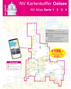
NV.Kartenkoffer Ostsee - NV.Atlas Serie 1, 2, 3 & 4
Special Price £249.00 Regular Price £339.96Stock In stock -
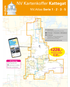
NV.Kartenkoffer Kattegat - NV.Atlas Serie 1, 2, 3, 5.1& 5.2
Special Price £269.00 Regular Price £404.95Stock In stock -
Baltic Sea Cruising Guides & Pilot Books


Baltic Sea Germany & Denmark NV.Atlases
-
-
-
-
NV.Kartenkoffer Ostsee - NV.Atlas Serie 1, 2, 3 & 4
Special Price £249.00 Regular Price £339.96Stock In stock -
NV.Kartenkoffer Kattegat - NV.Atlas Serie 1, 2, 3, 5.1& 5.2
Special Price £269.00 Regular Price £404.95Stock In stock -