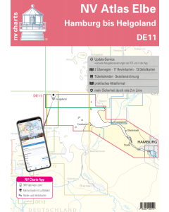
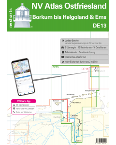
DE13: NV Atlas Ostfriesland - Borkum bis Helgoland & Ems

- FREE Delivery to UK - Spend over £75
- FREE Delivery to Europe - Spend over £150
- Worldwide Delivery Available
This atlas contains a download code for all charts in this area to be used with the nv chart app. The app is compatible with Apple: iOS/MacOSX, Android & Windows: 7/8/10.
Product Details
Part Number: YOT0006DE13
Scale: 1:1(Various)
ISBN: 9783945902134
Publisher: NV Charts
Edition: 2024
Printed and corrected to: edition date
Format: Combipack - Paper / Download and app
Language: English, German
MPN: 9826
The East Frisian islands of Borkum, Juist, Norderney, Baltrum, Langeoog, Spiekeroog and Wangerooge are both attractive and demanding. Seemingly endless expanse, the fresh breeze and long beaches characterize the archipelago off the coast of Lower Saxony - there is a lot to discover here for young and old. The islands are different in size and each has its own character, but the landscape is the same: sandy beach on the open sea side, dunes in the middle and marshland on the land side, where the Wadden Sea is located. In general the current-rich tidal water has well-developed marinas and supply options for guests.
With the up-to-date nautical charts of the NV chart set DE 13 you are optimally equipped for the navigational challenges on the German North Sea coast and tide & current information are included in the handy atlas as well as access to the NVcharts app. The charts for the sea area around Ostfriesland, Borkum, Helgoland and Ems are the professional cartography in the North Sea that has been optimized for recreational shipping. They contain all the information necessary for navigation in the difficult waters of the German Bight and additional harbour plans and details for approaches and passages in the waters. The chart set also contains the current tide information as well as current data relating to the tide diamonds in the charts.
This chart set includes
- 3 oversailers
- 15 cruising charts
- 16 details
- Tidal calendar and tidal currents included
- Digital charts for navigation program and nv charts app 365 day licence
- Port charts paper & Digital
- Navigation instructions in German and English
Update - Update
The chart sets for the German North Sea are published annually in updated editions. Up-to-date nautical charts are the basis of safe navigation. NV Charts offers a monthly update service for its German North Sea charts from April to October. So that you are always "up-to-date".
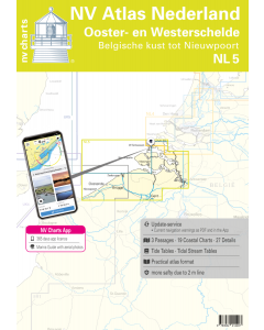
NV Atlas chart format
NV Charts nautical charts are available in an outstandingly practical, handy atlas booklet format and thus offer many advantages over formats from other manufacturers. The nautical chart series have been designed by nautical experts and passionate water sports enthusiasts with the needs of recreational boating in mind.
The NV Atlas has a very flat staple binding in the middle, so that the course triangle can also be used there without any problems. This innovative development makes it possible to look up charts quickly and always have them in the best possible order at the same scale. The NV Atlas is delivered in a plastic cover protected against splash water. This modern nautical chart format is very popular on sailing boats as well as on motor yachts and is the preferred choice of many of our customers.
NV Charts navigation app
All NV Charts nautical charts also include an access code to the digital nautical charts in the NV Charts app and can thus be easily downloaded and used for offline navigation with the NV Charts app on iOS, Android, PC and Mac or also in the web browser.
The NV Charts app is the ideal addition on mobile devices. With the app, you can already plan a detailed route at home and thus prepare for your journey in the best possible way in conjunction with the paper chart. The app is intuitive to use and, thanks to an identical map image, you can orientate yourself on paper and digitally in a matter of seconds. The most up-to-date information is essential to navigate safely on the water with your sailboat or motorboat.
With the NV Charts app, you now have the opportunity to become part of the chart community. You can mark harbours, anchorages and navigation warnings on the digital nautical chart and also add interesting places beyond navigation, such as restaurants, with pictures and comments and share your experiences with other users. In addition, the NV Charts app offers an automatic routing function, search and all navigation functions for GPS navigation with your phone or tablet. More information at: nvcharts.com/app
More PC navigation apps: NV Verlag / NV Charts nautical charts can also be used in many other nv.digital compatible PC navigation programs such as NV Chart Navigator or Open CPN.
Containing charts and scales
Oversailers
C1 East Frisia 1: 375.000 C2 Rottumerplaat to Norderney 1: 150.000 C3 Norderney to Wangerooge 1: 150.000
Maps of the area
C4 Westerems 1: 50.000 C5 Osterems 1: 50.000 C6 Dovetief 1: 50.000 C7 Norderney to Langeoog 1: 50.000 C8 Spiekeroog 1: 50.000 C9 Ansteuerung von Helgoland 1: 50.000 C13 Borkum to Dukegat 1: 50.000 C14 Dukegat to Emder Fahrwasser 1: 50.000 C15 Approach to Delfzijl 1: 25000 C16 Emder fairway 1: 25000 C17A Dollard 1: 50000 C18 Lower Ems to Leer 1: 25000 C19A/B Leer to Papenburg 1: 25000 C20 Papenburg to Lathen 1: 50.000
Detail maps
C10 Helgoland 1: 12500 C11A Borkum Hafen 1: 15000 C11B Dornumersiel 1: 12500 C11C Harlesiel 1: 12500 C11D Norddeich 1: 20.000 C11E Bensersiel 1: 12.500 C11F Langeoog Hafen 1: 12.500 C11G Neuharlingersiel 1: 7.500 C11H Norderney Hafen 1: 12.500 C11J Dove Harle 1: 25.000 C12A Baltrum Hafen 1: 7.500 C12B Spiekeroog harbour 1: 10000 C12C Juist harbour 1: 7500 C12D Leysiel lock 1: 7500 C12E Greetsiel harbour 1: 10000 C17 Emden 1: 12.500 General Notes - General Notes C11 Sign Explanation - Legend 21 Tide Calendar - Tide Tables 22-24